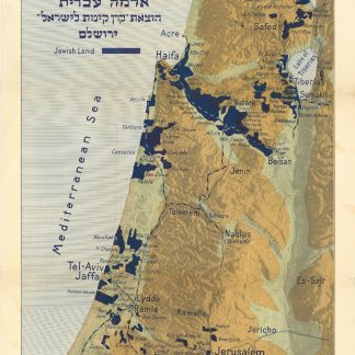
The Jewish National Fund purchasing land in Palestine
Erez Israel. Erets Yisra'el: adamah 'Ivrit.
Original colour-printed map. 368 x 610 mm on 415 x 660 mm. Relief shown by hypsometric tints and hill shading. Title in English and Hebrew.
€ 2,500.00
Rare Zionist map of Jewish-owned land in Mandate Palestine, reflecting the push of the Jewish National Fund (JNF) to acquire land for Jewish settlement. Areas shaded black indicate land owned by the JNF, who most likely founded many of the smaller settlements identified on the chart. Naturally, the map also indicates major cities including Jerusalem, Bethlehem, Tel Aviv, Jaffa, Haifa, and Gaza, along with major highways and railroads. Includes a portion of the Black Sea and Lake Tiberias.
The JNF, founded as part of the early 20th-century Zionist movement, acquired its first parcel of land in Palestine in 1903 as a gift from Russian Zionist leader Leib Goldberg. By 1921, the JNF owned almost 25,000 acres, and by 1927, that number had doubled. By 1939 about 108 Jewish communities had been founded, meaning that 10% of the Jewish population in Mandate Palestine were living on JNF land.
Only 5 copies listed in libraries worldwide (Yale University, Boston Public Library, John Hopkins University and Wisconsin Historical Society Library and Archives).
A few tears repaired with archival tape on the reverse. Faint tears and creases to upper margin. The image very well preserved.
OCLC 818645652.
Related
-
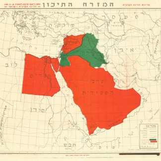
Ha’Mizrach Ha-Tichon (The Middle East) Ha’Liga Ha’Aravit (The Arab …Kfar Monash, 1949.
€ 2,800.00 -
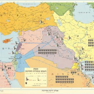
Mapah ha-neft ba-mizrah ha-tikhon (Map of the Oil Industry in the Middle …Jerusalem, 1963.
€ 2,500.00 -
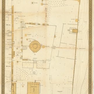
El Haram Esh Sharif.Tel Aviv, 1944.
€ 5,000.00 -
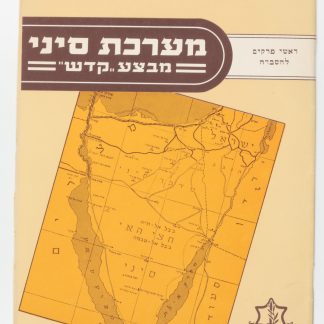
Ma’Rechet Sinai “Mivza Kadesh” (The Sinai War "Operation Kadesh").Tel Aviv, 1957.
€ 950.00