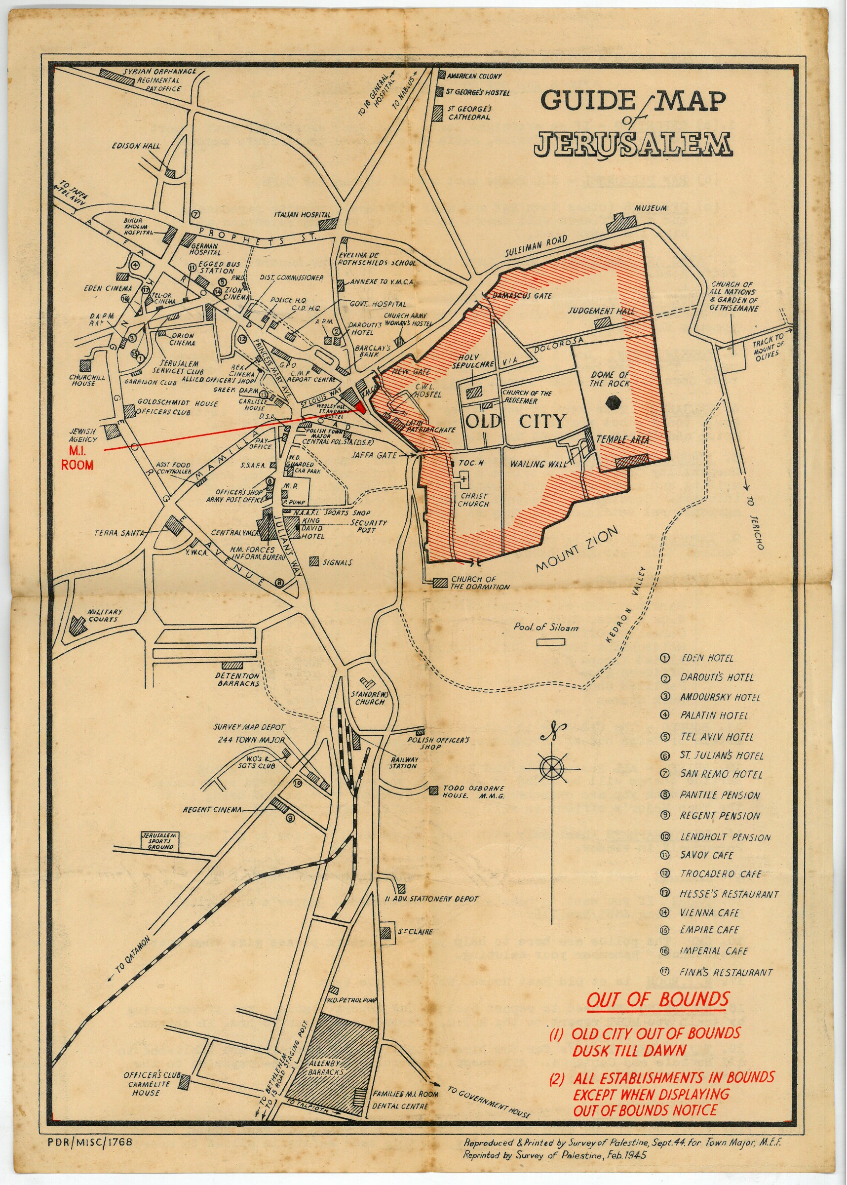
Guide Map of Jerusalem. PDR/MISC/1768.
Original black and red printed map. 260 x 368 mm.
€ 400.00
Rare plan of Jerusalem for the use of British soldiers. Produced in 1944 by the Survey of Palestine for the Town Major, reprinted in 1945. The map shows Jerusalem bounded by the Old City, Syrian Orphanage, and Allenby Barracks. Main features include hotels, cafes, military establishments, clubs, hospitals and the Medical Inspection Room. The perimeter of the Old City is shaded in red, with the note "Old City out of bounds dusk till dawn", while all other establishments are "in bounds except when displaying out of bounds notice".
The verso gives the Town Major's contact details, and lists "Do's and Don'ts while on leave", covering reporting, arms and ammunition, accommodation, valuables, Jerusalem Services Club, medical facilities, bounds, prices, photographs and parcels, as well as a warning about contracting venereal disease.
Somewhat spotted.
Not in OCLC.
Related
-
Weekly Military Intelligence Review.Jerusalem, General Headquarters Palestine, 17 May 1946 - 28 Feb. 1947.
€ 19,500.00 -
Palestine Survey Maps.Jerusalem?, 1942-1945.
€ 6,500.00 -
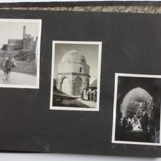
Photograph album of British Mandate Palestine.Mandate Palestine, ca. 1946.
€ 2,800.00 -
Ha-Ma'arakhah le-shihrur Yisra'el.Jerusalem, 1949.
€ 600.00