One Belt, One Road in 1826
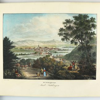
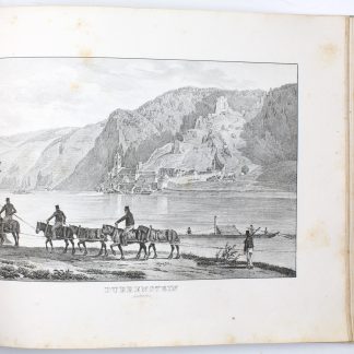
Zwey hundert vier und sechzig Donau-Ansichten nach dem Laufe des Donaustromes von seinem Ursprunge bis zu seinem Ausflusse in das schwarze Meer. Begleitet mit einer [...] Beschreibung von G. C. B. Rumy.
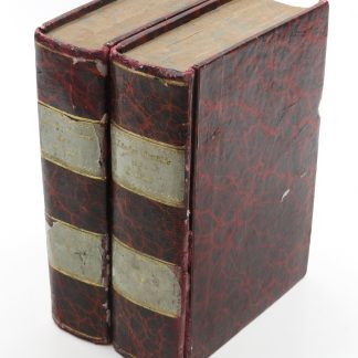
Large oblong folio (555 x 390 mm). With folding lithographed map and 264 coloured lithographed plates after Alt, Erminy, and others. Contemporary half calf with gilt-stamped spine and spine-label.
€ 75,000.00
A splendid set of views, probably the finest record ever published of the course of the Danube from its source to its outlet into the Black Sea. This is the only copy in contemporary colour known in the trade and in auction records of the last decades.
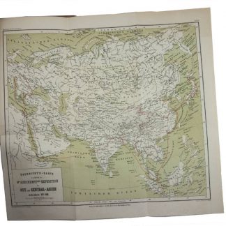
The Danube played a vital role in the settlement and political evolution of central and southeastern Europe. Its banks, lined with cities, castles and fortresses, formed the boundary between great empires, and its waters served as a vital commercial highway between nations. In the 21st century the river has continued its role as an important trade artery and is now a vital part of the New Silk Road project.
Contains views of Baden (nos. 1-3 & 5), Württemberg (nos. 4 & 6-11), Bavaria (nos. 12-48), Austria (nos. 49-123, 125), Hungary (126-157), and of the Balkan states and Turkey (nos. 158-264). Includes the complete text as well as the four-part, cloth-backed map. Complete copies are of the utmost rarity, and copies coloured throughout must be considered almost unobtainable. The auction records of the last 50 years list no more than six complete copies, of which this present one was the only one in original colour (Hartung & Hartung, Munich, sale 99 [2000], lot 787).
From the library of the Polish-Lithuanian nobleman and Austrian politician Anton Joseph Lanckoronski (1760-1830) and subsequently in that of his son, the great collector and patron of the arts Charles de Lanckoronski-Brzezie (1799-1863), with handwritten ownership to title-page.
Plate 58 (the first view of Linz) is present in its second variant, plate 235 (the first view of Orava) in both variants, but wants the view of Hainburg. Text slightly foxed and fingerstained, occasional wrinkling and slight edge flaws, lower margin of final text leaf damaged and reinforced. Plates printed on strong paper showing occasional foxing; insignificant dampstain to last third. Map disbound; covers restored.
Nebehay/Wagner 336. Not in Gilhofer Kat. 132 (Topographie in Österreich).
Related
-
Die Donau vom Ursprunge bis Belgrad. 71 Ansichten nach der Natur gezeichnet …Vienna, no year c. 1845.
€ 4,500.00 -
Länder-Gemälde des Orients, zur Verständniß der Begebenheiten unserer …Pest & Leipzig, 1840.
€ 3,500.00 -
Genre-Bilder aus dem Oriente. Gesammelt auf der Reise seiner Königlichen …Stuttgart, 1846.
€ 15,000.00 -
Im Fernen Osten. Reisen des Grafen Bela Széchenyí in Indien, Japan, China, …Wien, 1881.
€ 850.00