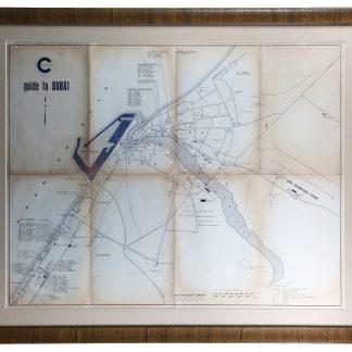
Dubai, mapped from 1968 to 1973
Guide to Dubai - Map.
Printed map (520 x 665 mm). Scale 1:20,000. Housed in 650 x 795 frame.
€ 8,500.00
Mapping the early days of Dubai's petroleum boom: produced by the Dubai Petroleum Company in 1968 and revised in 1973, the map offers a snapshot of Dubai at the very beginning of its mid-century transformation, one which was both economic and political. Right after the foundation of the Union and the Fateh Oil Field still new, the city itself was undergoing a process of expansion and renovation. Especially clear on the map are the new infrastructure innovations: Port Rashid on the Gulf shore, and the Dubai International Airport inland. Mosques, schools, and palaces are marked, and special attention is given to the residences of what are presumably Western employees of Dubai Petroleum Co.
Marginal waterstaining; toned at creases. In good condition.
Related
-

Carte de l’Empire Ottoman comprenant les possessions de la Porte en Europe, …Paris, 1825.
€ 3,000.00 -
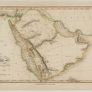
Arabia, Drawn and engraved for Dr Playfair's Atlas.Edinburgh, 1821.
€ 1,200.00 -
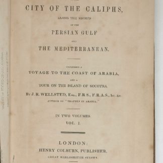
Travels to the City of the Caliphs, along the Shores of the Persian Gulf …London, 1840.
€ 6,000.00 -

Persian Gulf. ONC-H-6/7. Operational navigation chart.St. Louis, 1967.
€ 1,500.00