


One of 250 copies: the father of modern hydrography on the Indian Ocean
Oriental Repertory.
2 vols. Folio (260 x 322 mm). I: (2), 4, iv, 4, (2), iv, iv, iv, (4), 2-578 (actually 580) pp. With 16 plates as issued. II: (4), iv, iv, 4, 4, (4), 600, (16) pp. With 17 plates as issued. Including numerous folding maps. Modern half morocco.
€ 38,000.00
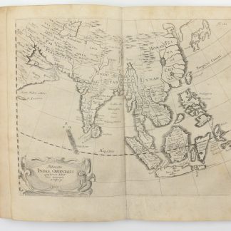
First edition, one of only 250 copies and complete with 33 plates, published by the Scottish geographer and hydrographer Alexander Dalrymple (1737-1808), Captain James Cook's leading rival. The first true British hydrographer, Dalrymple ranged across the coastlines of Arabia, East Africa, India, China, and Southeast Asia, charting and recording as he went. His detailed charts and surveying work revolutionized British access to areas considered particularly difficult and remote for British shipping, in particular southern China, the Muslim sultanate of Sulu, and the Arabian Gulf.
With thirty-three plates across two volumes, his Oriental Repertory covers history, geography, and ethnography of what is today Iraq, Iran, India, China, Vietnam, and Malaysia, and consists mostly of reports, charts, and translations produced by agents of the East India Company, including those of Dalrymple himself, nearly all previously unpublished.
Dalrymple was originally the chosen man to undertake the voyages eventually assigned to Captain James Cook, and remained bitter about Cook's selection for the rest of his life. He was the main proponent of the theory of a mysterious undiscovered continent in the South Pacific, Terra Australis Incognita, until Cook's second voyage showed that if this continent did exist, it would have to be located further south that the 65th parallel South. In pursuit of his own scientific theories, and in service of enriching the coffers of the East India Company (and partaking in some spying in service of Britain), Dalrymple developed modern hydrography, expanded British knowledge of Arabia, Southeast Asia, and China, and worked to collect his records and maps into his Repertory. He studied historical sources gathered from extensive archival research with newly obtained data straight from the ships and his own careful observations. These publications give a unique impression of the development of the scientific background that lay behind the trade of the British Empire in the East (Cook), and paved the way for British incursions into Arabia and the Philippines.
Rare, only two complete copies of the present first edition in auction records.
With one illegible library blindstamp.
A few very small, subtle repairs to maps, one map "Map of part of the Northern Cicars" with closed tear; minor paper repairs to beginning of volume I. In excellent condition.
Cook A192, A251.
Related
-

Vierzig-Jährige Reise-Beschreibung. Worinnen dessen durch Türkey, Persien, …Nuremberg, 1681.
€ 8,500.00 -
Around the World to Persia. Letters Written While on the Journey as a Member …New York, 1920.
€ 1,750.00 -
Morgenländische Reyse-Beschreibung.Hamburg, 1658.
€ 11,000.00 -
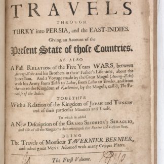
Collections of travels through Turky into Persia, and the East-Indies. …London, 1684.
€ 8,500.00
