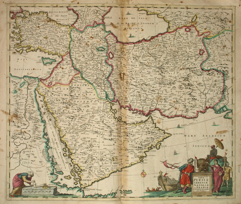
Nova Persiae Armeniae Antoliae et Arabiae.
[Amsterdam, 1690].
Oblong folio (590 x 500 mm). Engraved map in contemporary hand colour. Decorative cartouche, compass rose.
€ 2,300.00
Beautiful example of Cornelis Danckerts’ map showing the Arabian Peninsula, Persia, Turkey, Cyprus, Egypt, and the eastern part of the Mediterranean. Slightly brownstained; otherwise in fine condition.
References
Al Ankary 77.