
The first modern map of the East
La descrittione della prima parte dell'Asia.
Engraved map on two sheets, joined. 440 x 745 mm.
€ 35,000.00
Extremely rare: The very first state of Giacomo Gastaldi's influential map of the Near and Middle East, covering Asia Minor and the Levant coast to Afghanistan, including Iran, northern Arabia, and the Caspian Sea.
Gastaldi's mapping of Asia, published in three parts, is considered one of the most influential cartographical ventures in the 16th century. All his maps would go on to be prototypes for the depiction of the region well into the early 18th century. As official cosmographer to the Venetian Republic, Gastaldi had access to the most up-to-date geographical information in compiling his maps, which represent the most accurate and detailed renderings of their time. Having been established in the city for two decades, by the late 1550s Gastaldi was devising the large-scale monumental masterpieces that would confirm his legacy. The travels of Marco Polo, published in Ramusio's "Navigationi et viaggi", heavily influenced Gastaldi's geography, and this map is considered far superior to all previous maps of the region.
A fine example of the principal 16th century map of Arabia and the Middle East.
In excellent state of preservation.
Bifolco/Ronca, Geografia e Topografia Italiana del XVI Secolo I, 68 (1st state). Karrow 30/85.1. Nordenskiold II, 130, 57.
Related
-
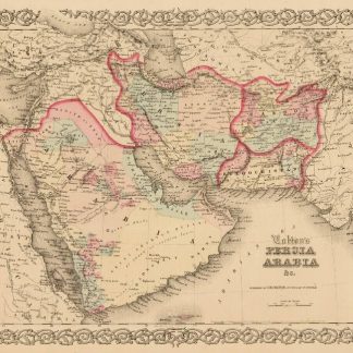
Persia Arabia &c.New York, 1858.
€ 500.00 -
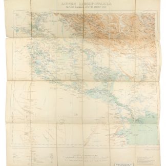
Lower Mesopotamia Between Baghdad and the Persian Gulf.London, 1917.
€ 1,500.00 -

The complete series of the first 200 works issued by the Hakluyt Society.London, 1847-1958.
€ 165,000.00 -
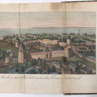
Neue Reise in Arabien, die europäische und asiatische Türkey. Nach dem …Leipzig, 1814.
€ 2,500.00
