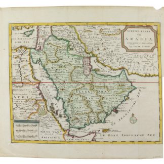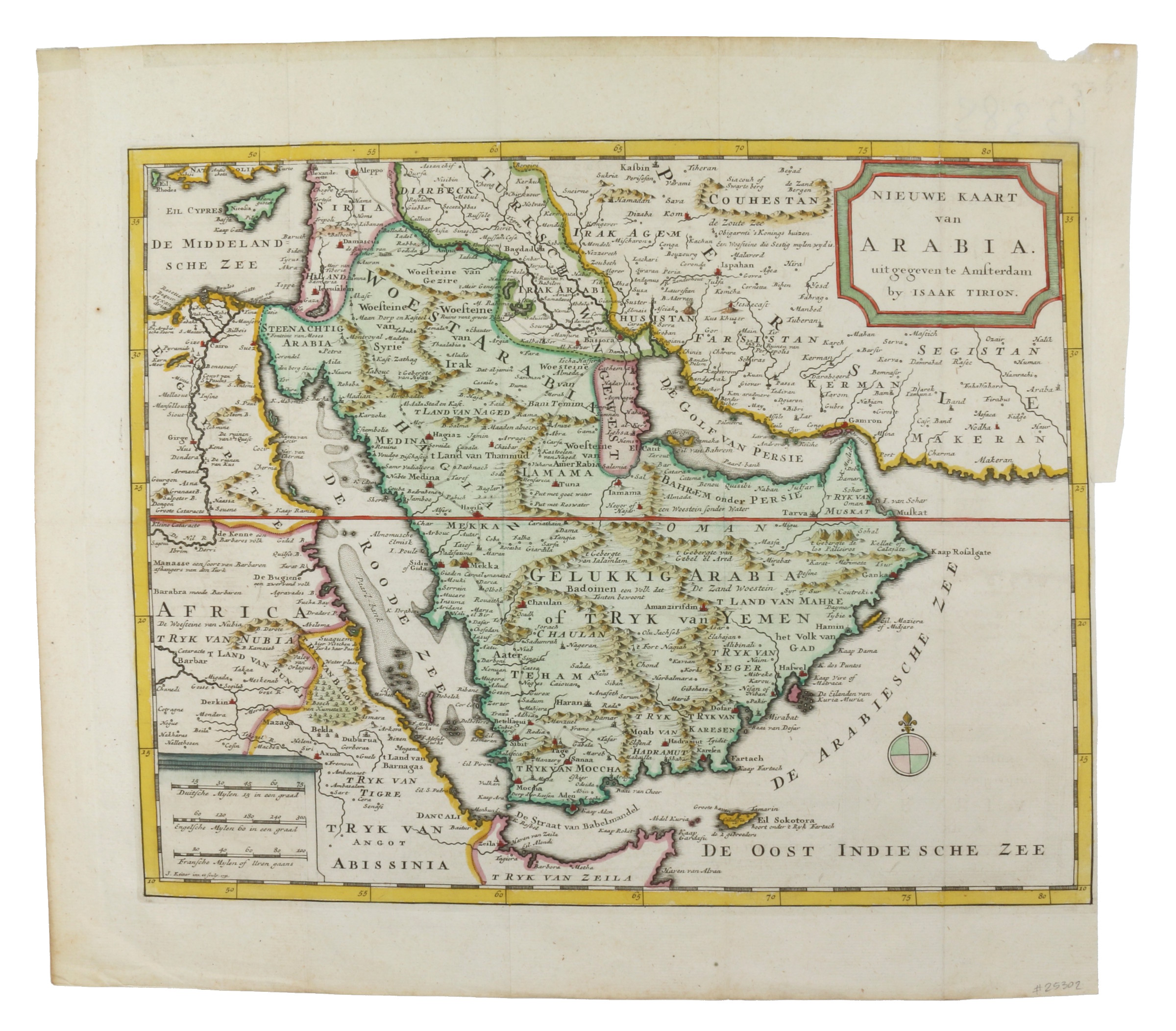
Nieuwe Kaart van Arabia.
Amsterdam, J. Keizer, 1731.
Hand-coloured engraved map (355 x 290 mm).
€ 1,250.00
Striking full-colour example of Tirion's detailed map. The map is highly detailed, including a number of the major roads and caravan routes, including those leading to Mekka and Medina. Two monument-style cartouches contain the title at upper right and three distance scales opposite. "This map shows a great advance on the others by showing the true extent of Turkish power. It has a curious mountain system, dividing the Peninsula into smaller regions" (Tibbets). Although it is mainly based on Delisle's map through de Fer, the map contains much original data.
Very well preserved.
References
Tibbetts 250. Al Ankary p. 330. Al-Qasimi 160.
Related
-
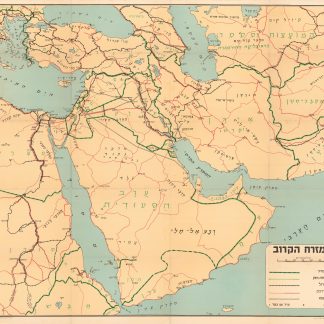
Ha-mizrah ha-karov (The Near East).Tel Aviv, 1958.
€ 3,500.00 -
![Northern Arabia according to the original investigations of Alois Musil [...].](https://inlibris.com/wp-content/uploads/2020/05/img-bn50160-324x324.jpg)
Northern Arabia according to the original investigations of Alois Musil …New York, 1926.
€ 3,500.00 -
![Arabia and the Persian Gulf. N.W. Section, S.W. Section. [Map of Arabia and the Persian Gulf with additions and corrections to 1916].](https://inlibris.com/wp-content/uploads/2021/11/img-bn51281-324x324.jpg)
Arabia and the Persian Gulf. N.W. Section, S.W. Section. [Map of Arabia …Dehra Dun, 1916.
€ 8,500.00 -

Iran (Persia) and Iraq.London, 1930s.
€ 650.00