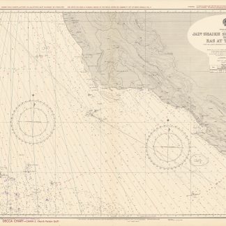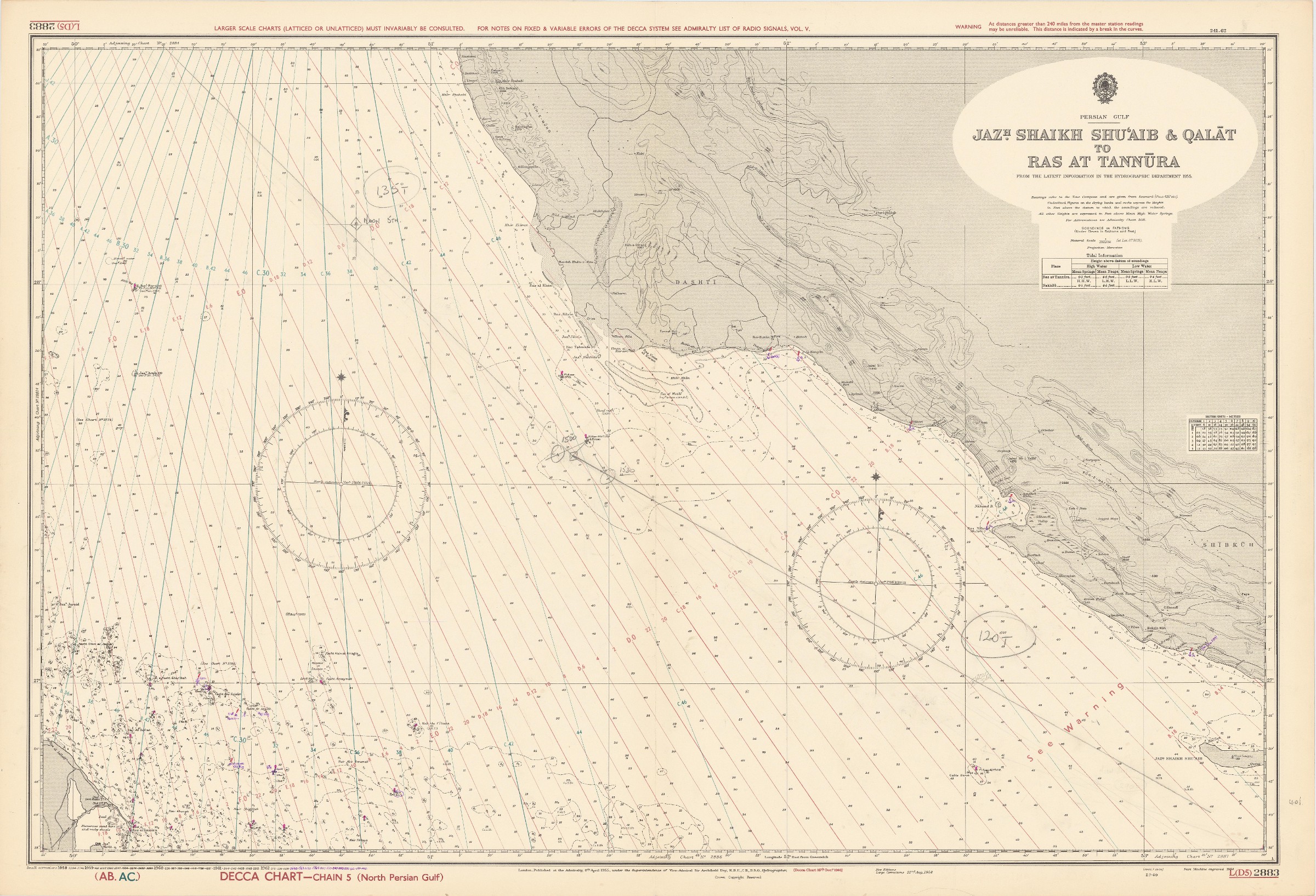
Persian Gulf. Jazh. Shaikh Shu'aib & Qalat to Ras at Tannura. From the latest information in the Hydrographic Office. L (D5) 2883.
London, published at the Admiralty, 1962-1964.
1040 x 710 mm. Scale 1:350,000.
€ 1,000.00
Nautical chart of the Arabian Gulf off the coast of Ras Tanura on the north-eastern coast of the Arabian Peninsula, with parts of the southern coastline of Persia. Including tidal information, compass roses, soundings, seabed notations, currents, sandbanks, shoals, inland elevations (including a "conspicuous tree" on the island of Shaikh Shu'aib). This edition first published in 1955, with large corrections in 1958 and smaller ones in the subsequent years to 1964 (overstamped or handwritten).
Folded; some pencil annotations but very well preserved. Provenance: from the archives of Lilley & Reynolds Ltd., suppliers of Navigation Equipment.
Related
-

United Arab Emirates Abu Dhabi. Mina Zayed Tariff Rules.Abu Dhabi, 1970s.
€ 650.00 -
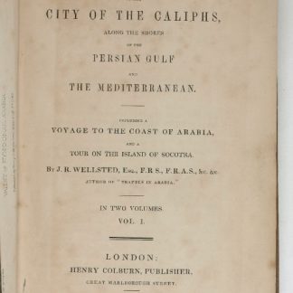
Travels to the City of the Caliphs, along the Shores of the Persian Gulf …London, 1840.
€ 6,000.00 -

Persian Gulf Pilot. Comprising the Persian Gulf and its Approaches, from …London, 1967.
€ 950.00 -

Carte de l’Empire Ottoman comprenant les possessions de la Porte en Europe, …Paris, 1825.
€ 3,000.00