The Saudi Arabia and Jordan border region before the 1965 revision
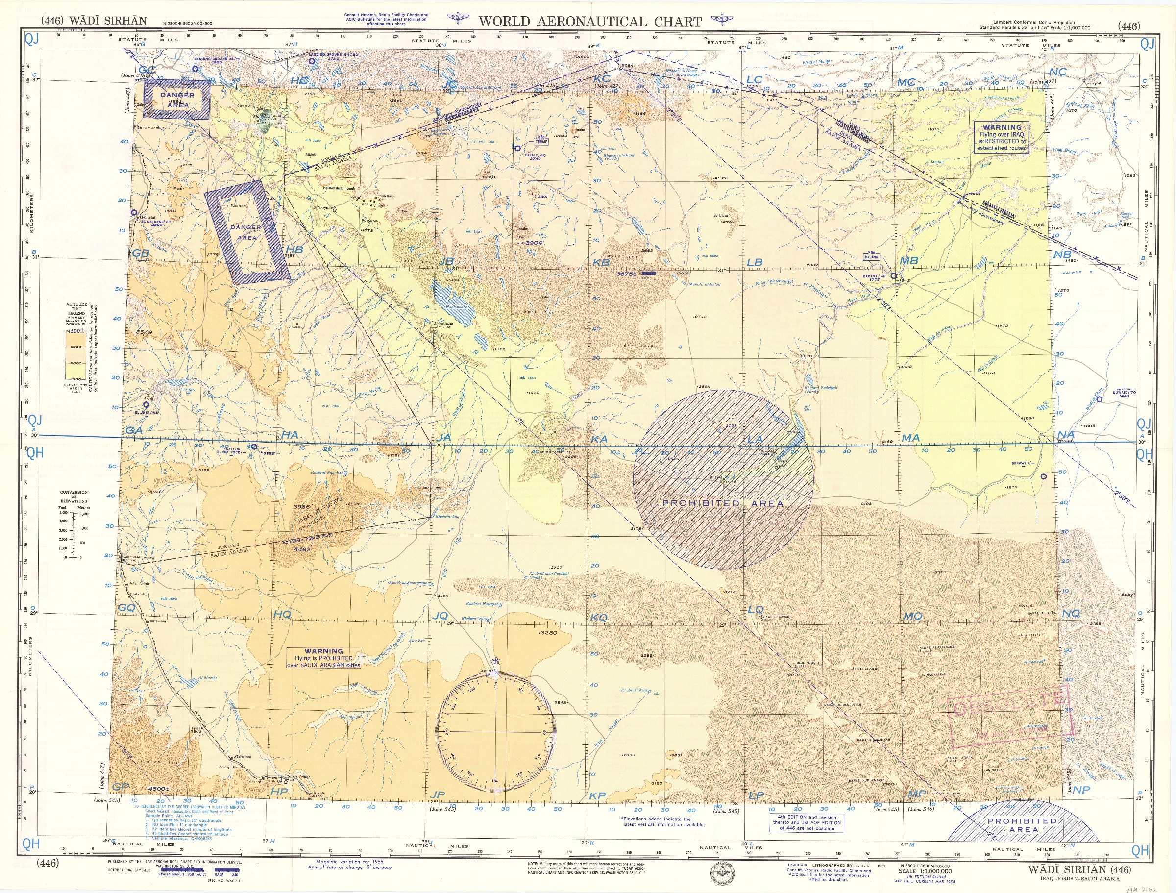
USAF aeronautical chart and information service. World aeronautical chart (446) Wadi Sirhan.
Washington, DC, USAF aeronautical chart and information service, 1958.
Colour-printed map, 560 x 735 mm, with a legend printed on the back. Scale 1:1,000,000.
€ 950.00
Pilot's map of Wadi Sirhan in the border region of Iraq, Saudi Arabia and Jordan. The map shows the concave and zigzagging border between Saudi Arabia and Jordan before its revision in 1965. The indefinite nature of the borders is clearly visible on the map in the changed and crossed-out borderlines and the notations "boundary approximate". Several areas are marked as "danger area" or "prohibited area".
Stamped "obsolete for use in aviation", otherwise in excellent condition.
Related
-
Blizhnij i srednij vostok.Moscow, 1972.
€ 400.00 -
Mapah ha-neft ba-mizrah ha-tikhon (Map of the Oil Industry in the Middle …Jerusalem, 1963.
Inquire -

Reize naar Arabië en andere omliggende landen.Amsterdam & Utrecht, 1776-1780.
€ 6,000.00 -

Voyage en Arabie & en d'autres Pays circonvoisins. Tome premier (-second). …Amsterdam & Utrecht, 1775-1780.
€ 6,000.00