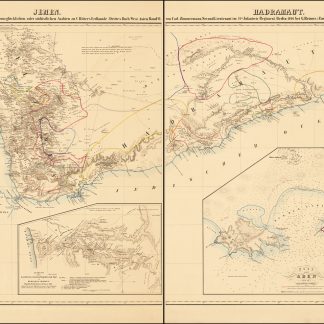
Jemen. Hadramaut. Versuch einer Darstellung vom glücklichen oder südöstlichen Arabien zu C. Ritter's Erdkunde (Drittes Buch West Asien Band VI) von Carl Zimmermann, Second-Lieutenant im 21ten Infanterie Regiment. (Zum Atlas von Vorder Asien gehörig).
Berlin, G. Reimer, 1846.
Engraved map. 1245 x 690 mm (if joined).
€ 950.00
Fine large-format map of the southern portion of the Arabian Peninsula. Includes a large inset plan of Aden and smaller inset maps of the island of Socotra and a smaller map of the routes to Mecca. Illustrates the indigenous peoples, towns, topography and trade routes in the region.
2 sheets, unjoined.
Related
-
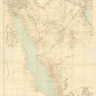
Arabia and the Persian Gulf. N.W. Section, S.W. Section. [Map of Arabia …Dehra Dun, 1916.
€ 8,500.00 -
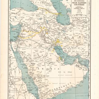
Arabia and near bordering countries. Includes: Palestine, Iran (Persia) …Chicago, ca. 1936-1941.
€ 1,500.00 -
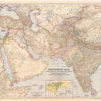
Southwest Asia, India, Pakistan, and Northeast Africa.Washington, DC, 1952.
€ 850.00 -

Persian Gulf. ONC-H-6/7. Operational navigation chart.St. Louis, 1967.
€ 1,500.00