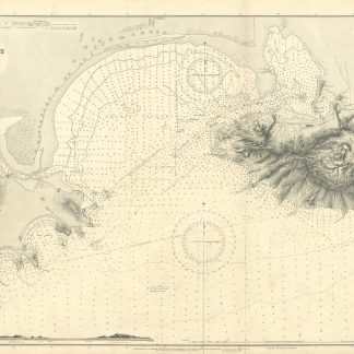
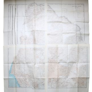
Aden Harbour and Approaches. No. 7.
Standard issue, 710 x 1264 mm. Scale 1:24,300.
€ 350.00
Fine nautical chart of the port of Aden, historically a major hub of transportation for the region, prepared by the British Admiralty. Undoubtedly one of the better antiquarian maps of Aden under British administration. With a small panoramic view of the peninsulas of Aden and Little Aden.
The chart shows the Aden Peninsula with the city and harbour, as well as Little Aden peninsula and Bander Tauwahi. It details the port area, labeling the clock tower, the market, the cemetery, the Prince of Wales pier, police lines and telegraph stations, as well as Marbut Hill, Chapel Hill and Barrack Hill. It includes the mountainous Aden Peninsula and Gold Mohur Valley, as well as smaller islands such as Flint Island, Slave Island, and Sirah. On Little Aden the chart includes the Sheikh Ghadir temple as well as Mount Sugarloaf. In addition, the chart marks a quarantine area between both peninsulas for sea-going vessels.
The British Admiralty has produced nautical charts since 1795 under the auspices of the United Kingdom Hydrographic Office (HO). Its main task was to provide the Royal Navy with navigational products and service, but since 1821 it has also sold charts to the public. The present chart was composed after Admiralty surveys of 1906; it was first published in 1907 and saw several corrections up to 1936.
With two folds. A few manuscript notes. Slightly brownstained.
Related
-
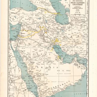
Arabia and near bordering countries. Includes: Palestine, Iran (Persia) …Chicago, ca. 1936-1941.
€ 1,500.00 -
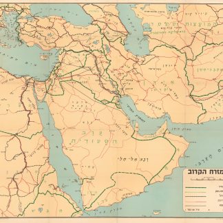
Ha-mizrah ha-karov (The Near East).Tel Aviv, 1958.
€ 3,500.00 -
A contribution to the geography and cartography of north-west Yemen (based …Cairo, 1939.
€ 2,800.00 -
Northern Arabia according to the original investigations of Alois Musil …New York, 1926.
€ 3,500.00