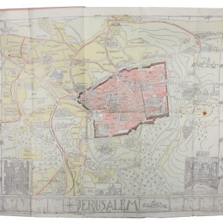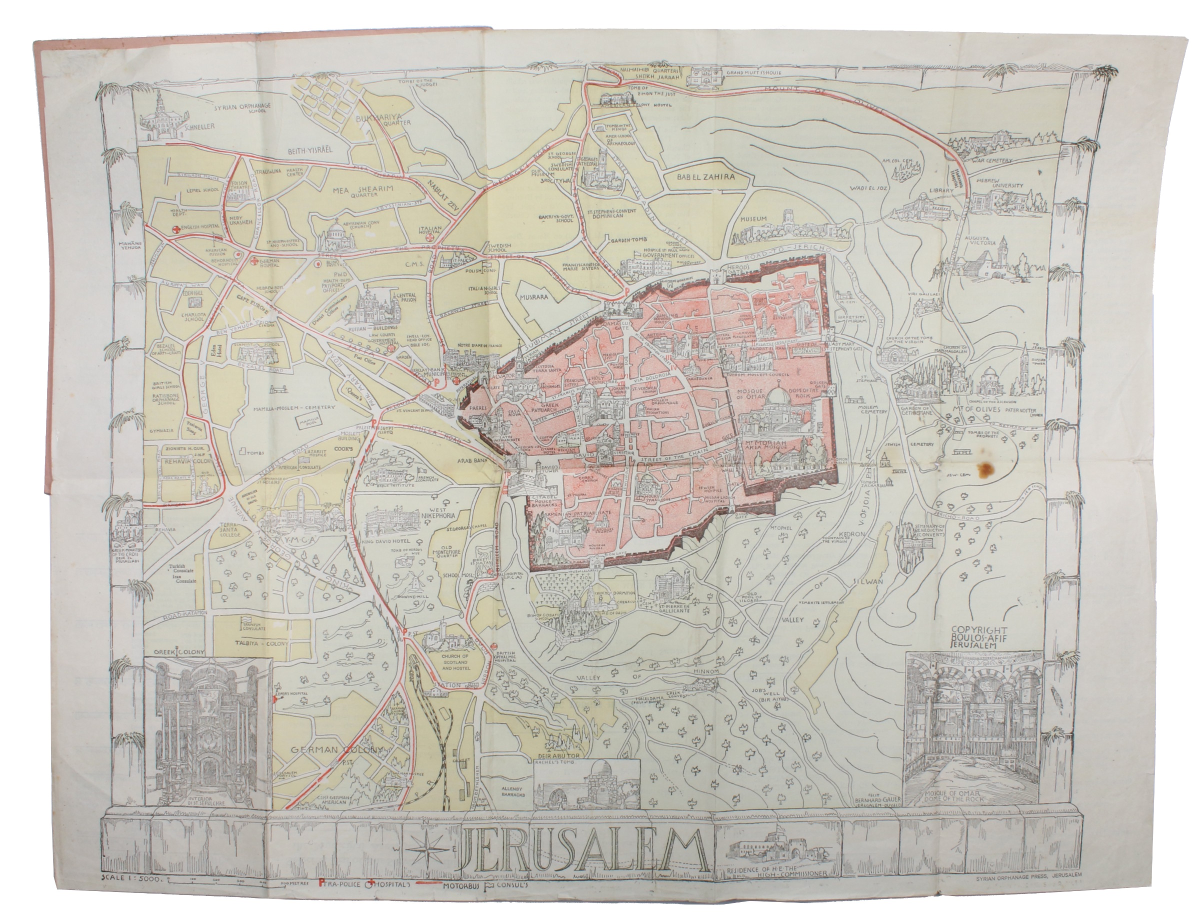
Uncommon hand-coloured map of British Mandate Jerusalem
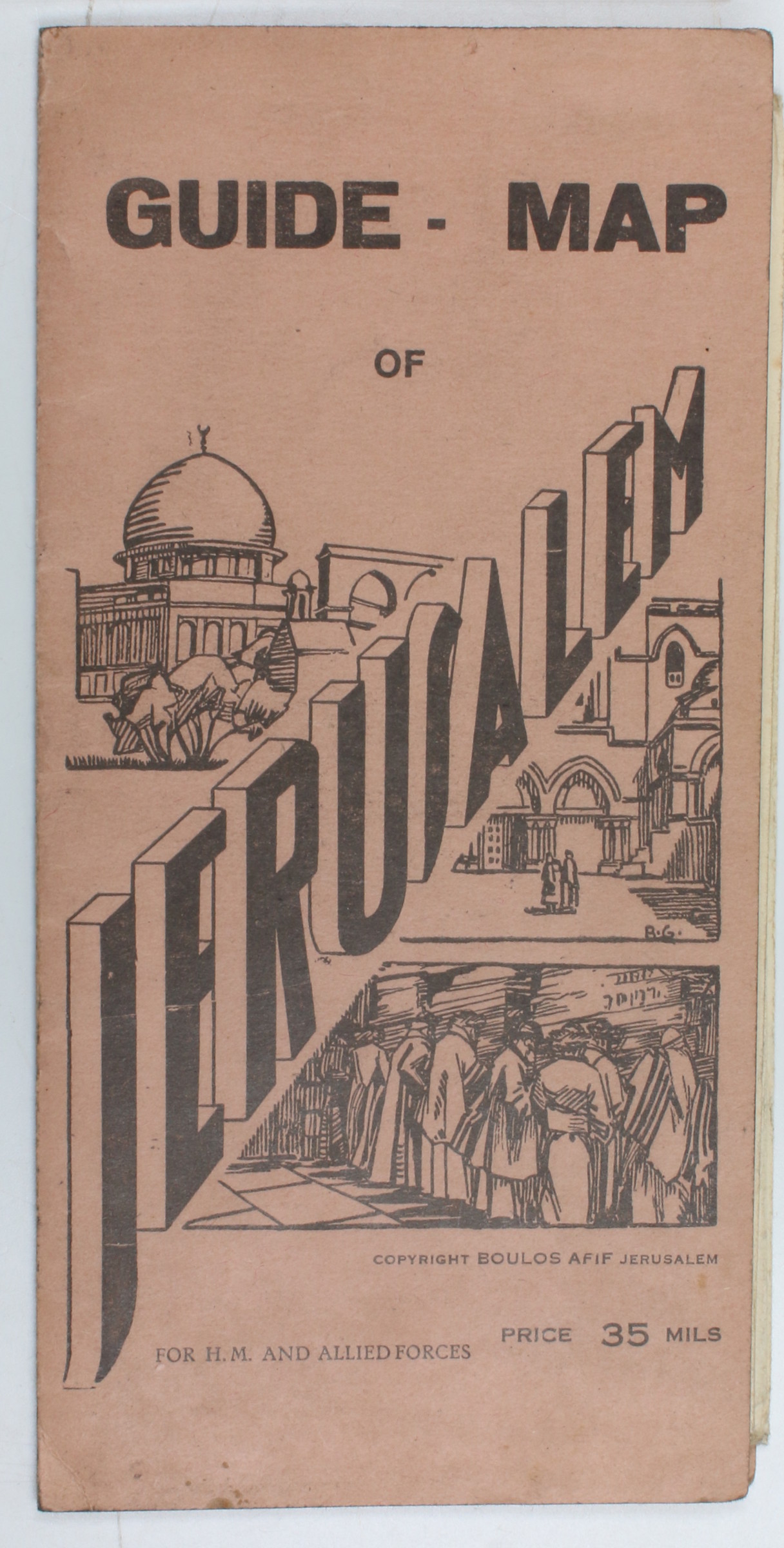
Guide-Map of Jerusalem.
565 x 441 mm chromolithograph map, folding down to a 240 x 120 mm pamphlet. Original pink wrappers.
€ 500.00
A rare map of Jerusalem during the British Mandate Period, printed especially for British and allied forces stationed in the area. The map is a chromolithograph by the Düsseldorf-born artist Bernhard Gauer (1882-1955), with outer districts pleasantly hand-coloured in yellow and pale green and selected buildings depicted pictorially. On the reverse is a brief guide to everything a serviceman was expected to need in Jerusalem: churches of various denominations (Church of England, Methodist, Greek Orthodox, etc.), four Masonic lodges, officer's clubs for the well-to-do and YMCAs and hostels for the less affluent, and, naturally, bookshops. A map of Palestine and southern Syria is printed on the rear wrapper. An uncommon and thorough guide to the city, from the minutiae of taxi service rates to the locations of holy sites and Europeans' preferred neighborhoods.
Light wear, otherwise in excellent condition.
OCLC 1100427555.
Related
-
USAF aeronautical chart and information service. World aeronautical chart …Washington, DC, 1958.
€ 950.00 -
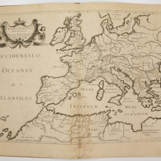
Antiquorum Patriarchatuum Descriptio.Paris, 1640.
€ 3,500.00 -
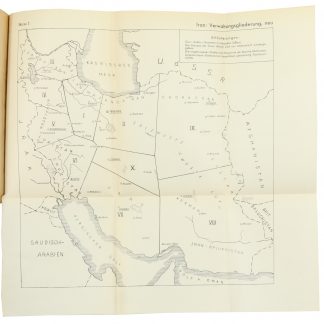
Entwurf! Militärgeographische Angaben über Iran: Ortschaftsverzeichnis; …Berlin, 1943.
€ 6,500.00 -

Voyage en Arabie & en d'autres Pays circonvoisins. Tome premier (-second). …Amsterdam & Utrecht, 1775-1780.
€ 6,000.00