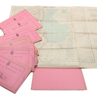
Palestine Survey Maps.
505 x 605 mm. 4 original colour-printed maps. Scale 1:100,000.
€ 2,000.00
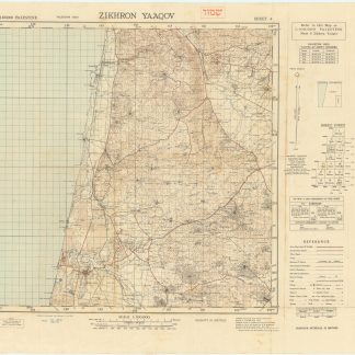
A fine set of topographical maps prepared by the Survey of Palestine, which was a direct result of the 1917 Balfour Declaration. Includes two maps of the 1949 edition prepared for the Israeli Defense Forces, indicating the immense value these maps had for military purposes.
"The cadastral survey proceeded in fits and starts, through the Great Revolt of 1936-1939 and World War II. By the end of the mandate, the land was settled in less than 20 percent of Palestine, primarily in areas where Jewish colonies were established, such as the coastal plain, the Marj Ibn Amer valley, and north of Lake Tiberias by the Jordan River. The topographical maps were completed for all of Palestine, excluding the lower Negev. These were very valuable for military purposes during World War II" (Sitta).
Shows the district and sub-district boundaries, plus roads, notable buildings, police stations, minarets, in some cases Sheikh's tombs etc. The maps are as follows: 4. Zikhron; 8. Yibna; 12. Hebron; 15. Beersheba.
Very well preserved.
Salman Abu Sitta, [review:] "A Survey of Palestine under the British Mandate, 1920-1948", in: Journal of Palestine Studies 35.2 (Winter 2006), p. 102.