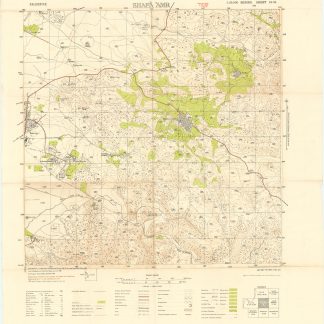
Palestine Survey Maps.
565 x 680 to 630 x 755 mm. 5 original colour-rinted maps. Scale 1:20,000.
€ 1,800.00
A set of maps from the topographical-cadastral map series prepared by the Survey of Palestine which was a direct result of the 1917 Balfour Declaration.
"The cadastral survey proceeded in fits and starts, through the Great Revolt of 1936-1939 and World War II. By the end of the mandate, the land was settled in less than 20 percent of Palestine, primarily in areas where Jewish colonies were established, such as the coastal plain, the Marj Ibn Amer valley, and north of Lake Tiberias by the Jordan River. The topographical maps were completed for all of Palestine, excluding the lower Negev. These were very valuable for military purposes during World War II" (Sitta).
Showing the district and sub-district boundaries, plus roads, notable buildings, police stations, minarets, in some cases Sheikh's tombs etc. The maps are as follows: Caesarea, sheet 14-21; Ijzim, sheet 14-22; Acre, sheet 15/25, 16/25 composite; Umm Ez Zinat, sheet 15-22; Shafa 'Amr, sheet 16-24.
Occasionally somewhat creased and toned; small edge flaws, sometimes repaired with archival tape. The bulk of the set very well preserved.
Salman Abu Sitta, [review:] "A Survey of Palestine under the British Mandate, 1920-1948", in: Journal of Palestine Studies 35.2 (Winter 2006), p. 102.
Related
-
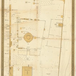
El Haram Esh Sharif.Tel Aviv, 1944.
€ 5,000.00 -
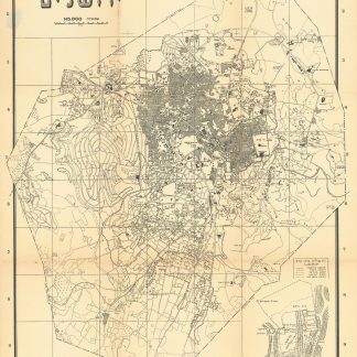
Mapat Yerushalayim [Map of Jerusalem].Jerusalem, 708 1947 or 1948.
€ 450.00 -
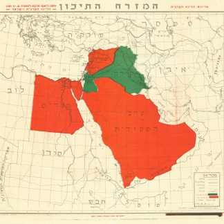
Ha’Mizrach Ha-Tichon (The Middle East) Ha’Liga Ha’Aravit (The Arab …Kfar Monash, 1949.
€ 2,800.00 -
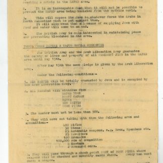
British military documents from Mandate Palestine.Mandate Palestine, 1948.
€ 2,500.00