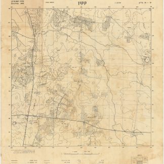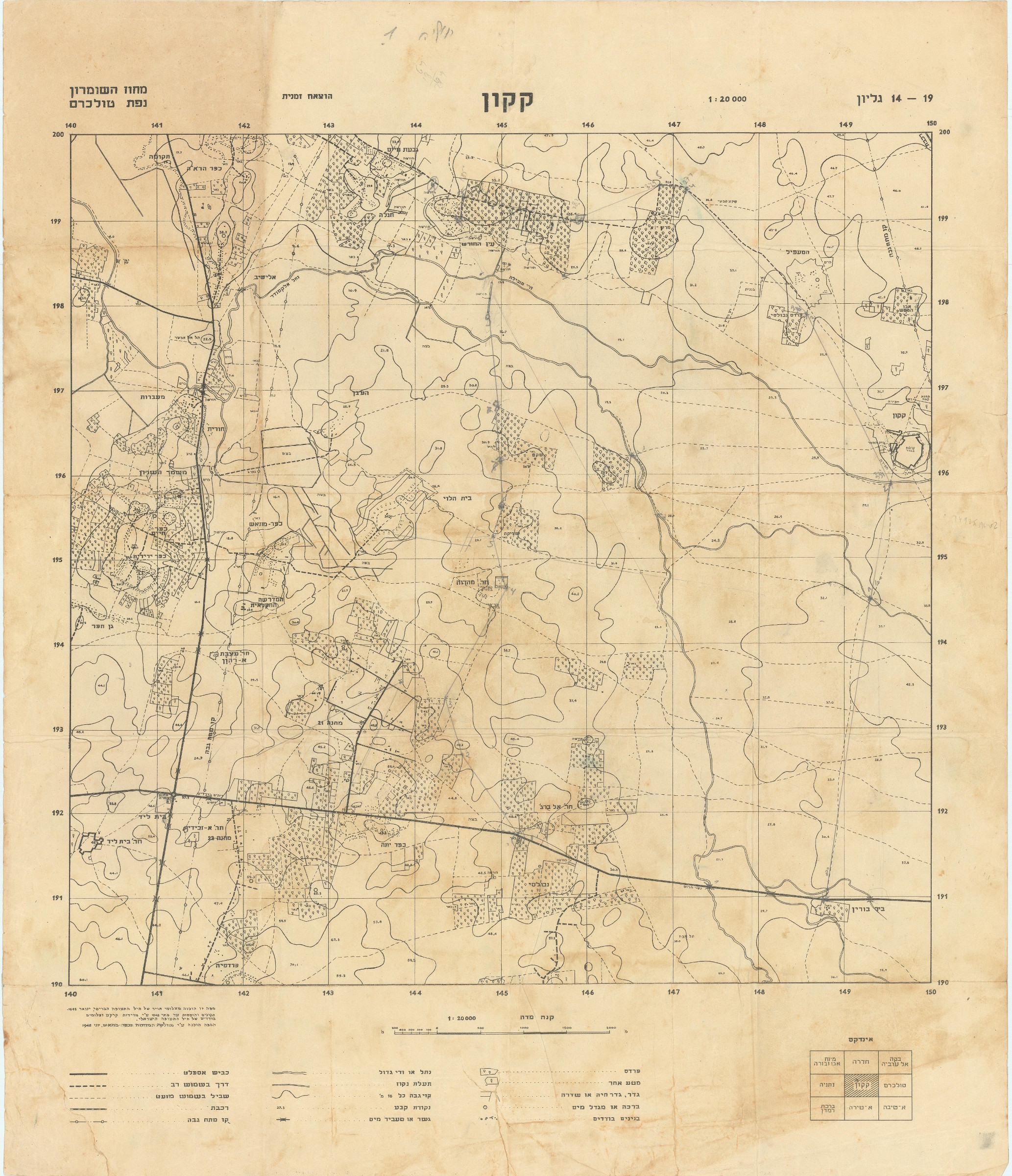
Qaqun. Sheet 14-19.
580 x 658 mm. Lithographed map. Scale: 1:20,000. Folded.
€ 250.00
A rare map of the Palestinian Arab village Qaqun (northwest of Tulkarm) and its surroundings, prepared by the Israel Survey Department, in the year of Israel's foundation and of the first Israel-Arab War. At the bottom it is stated that the map was prepared from British Air Force aerial photographs taken in 1945, with corrections and additions made through the ground measurements and individual photographs by the Israeli Air Forces in May 1948, and was printed in June 1948. Key and index in Hebrew.
The map is remarkable for being printed during the 1948 Arab-Israeli War, the first war after the foundation of Israel; it was also printed in the month of the occupation of Qaqun. The village had already been raided by the Irgun on 6 March and was occupied by Israel Defense Forces on 7 June 1948.
A copy is held by the National Library of Israel's Eran Laor Cartographic Collection (Israel h89).
A pencil line hand-drawn from "Geulim" passing from "Ein ha-Horesh", Qaqun to Bir Burin marking more than ten villages. A few scribble in the edges. Browning, stains, folding marks, creases.
OCLC 914349658.
![Hasahar Hapore [The Fertile Crescent].](https://inlibris.com/wp-content/uploads/2024/01/img-bn61399-324x324.jpg)