The Ordnance Survey of Arabia
The Hejaz. Southwestern Arabia.
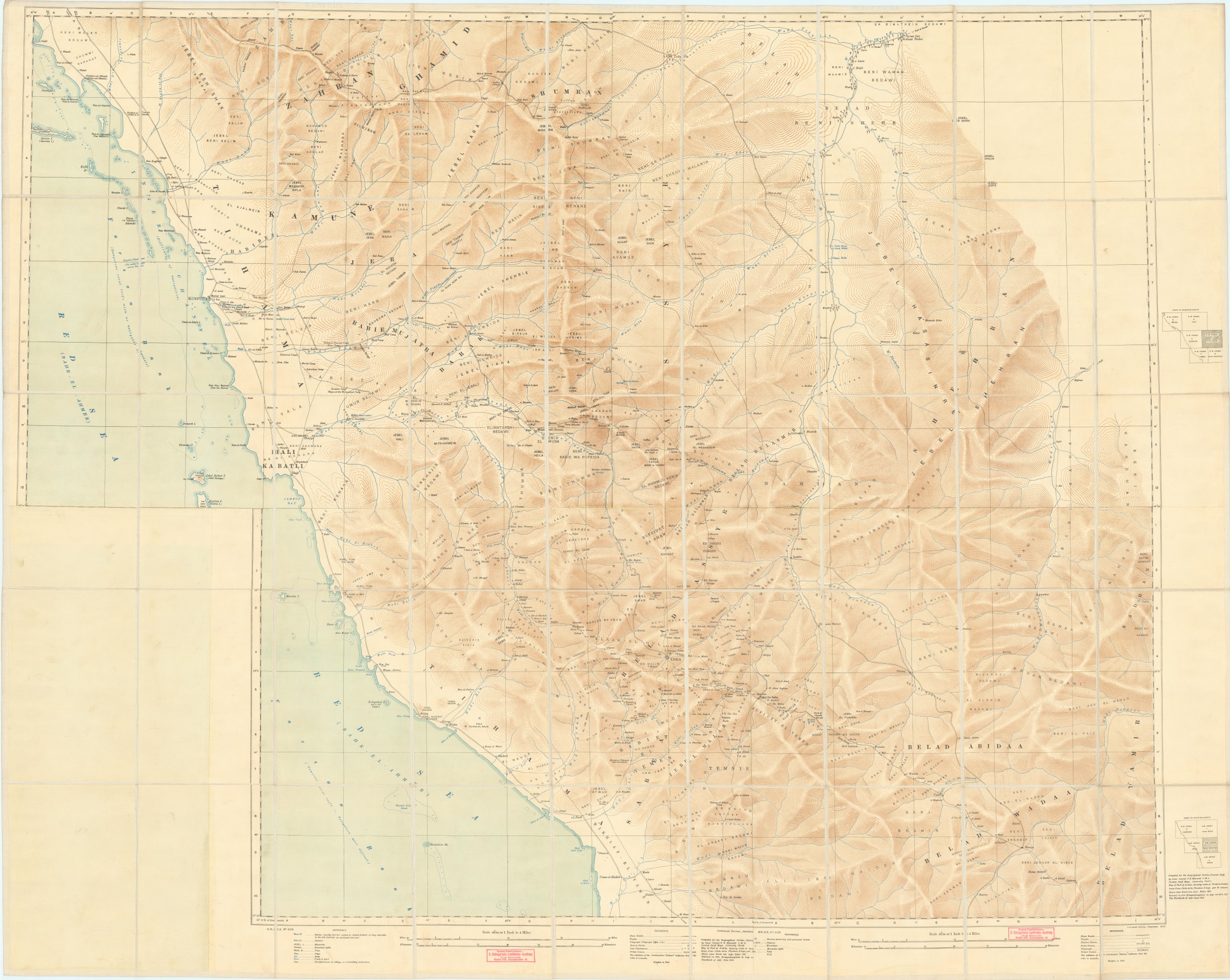
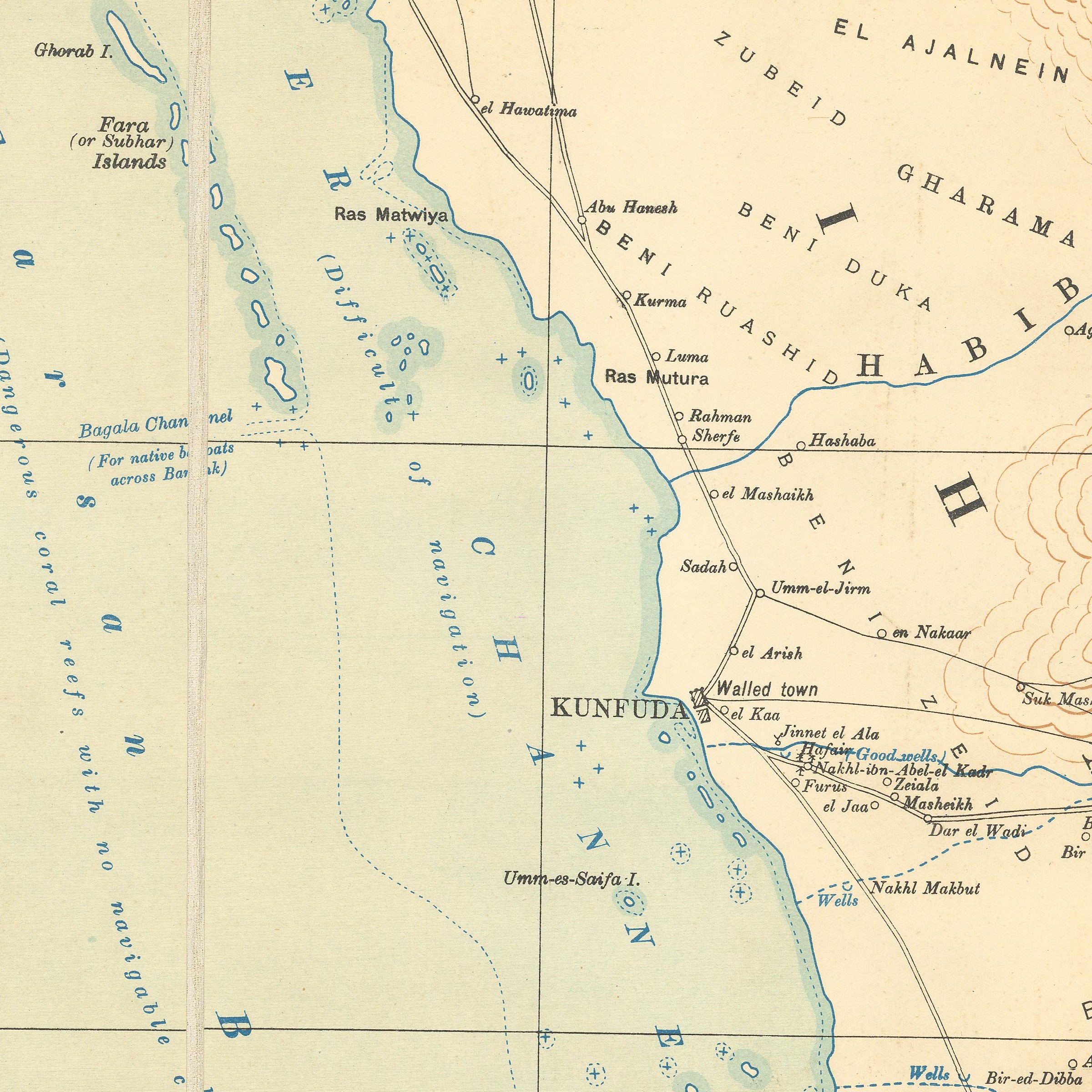
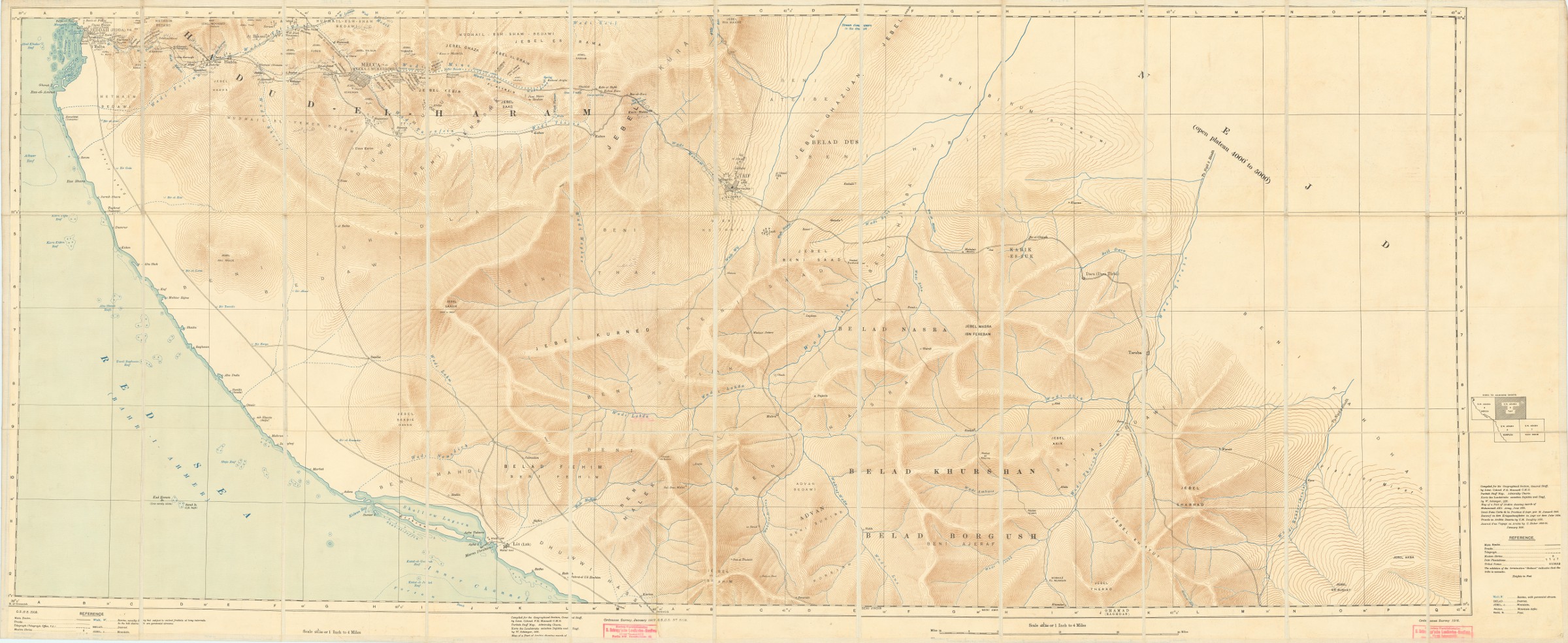
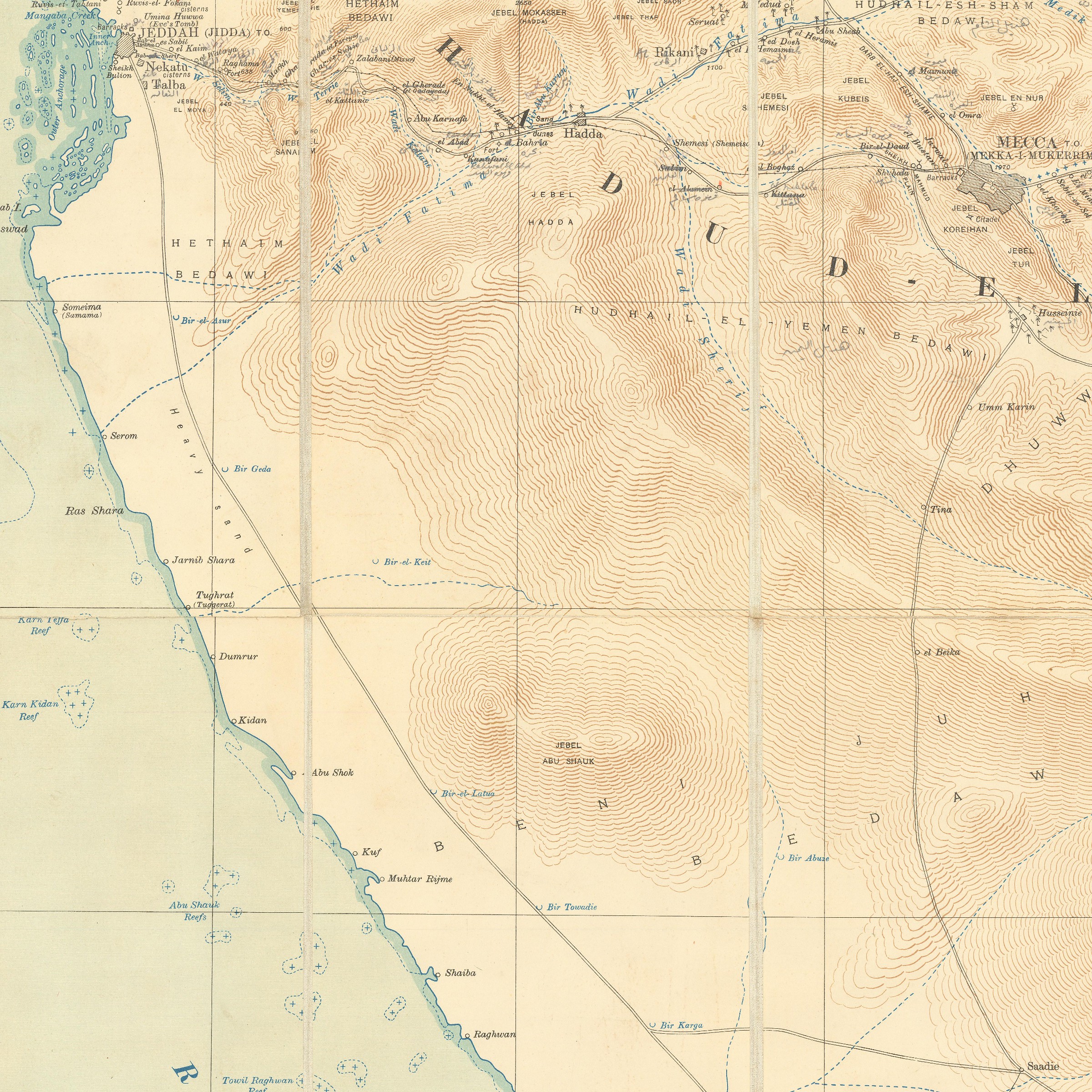
Sheets 5, 6, 7, 8, 9, of the Ordnance Survey of S.W. Arabia. Sheets 5 (S.W. Arabia, Wadi Shehran), 6 (S.W. Arabia Kunfuda), & 7 (S.W. Arabia Wadi Bishe), joined and laid on linen in sections, overall size 162 x 131.5 cm; sheets 8 (S.W. Arabia Mecca) and 9 (S.W. Arabia Taif) joined and laid on linen in sections, overall size 171.5 x 72 cm.
A rare group of map sheets of the Hejaz from the pioneering Ordnance Survey of Arabia. The present sheets include Mecca and Jeddah. They are part of a series of nine large-scale maps of the southwestern portion of the Arabian Peninsula.
The maps were created by the British Ordnance Survey in co-operation with the Geographical Section of the General Staff at the War Office. The geography and ethnography is the product of research by Lt. Col. F. R. Maunsell (1861-1929), a British army intelligence officer, traveller, and mapmaker. Maunsell’s listed sources date from 1824 to 1916 and include a Turkish staff map, Admiralty charts, and German, French, and British works. Distance scales are given in kilometres and miles, and relief is indicated by contour lines and spot elevations in feet.
Related
-
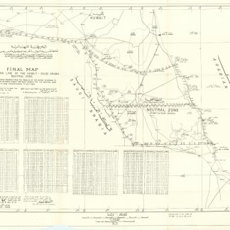
Final map of dividing line of the Kuwait - Saudi Arabia Neutral Zone.N. p., August 1968.
€ 3,500.00 -

Voyage en Arabie & en d'autres Pays circonvoisins. Tome premier (-second). …Amsterdam & Utrecht, 1775-1780.
€ 6,000.00 -
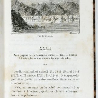
Les mystères du désert. Souvenirs de voyages en Asie et en Afrique.Paris, 1859.
€ 950.00 -
Begebenheiten einer Reise auf dem rothen Meer, auf der arabischen und ägyptischen …Leipzig, 1781.
€ 1,800.00