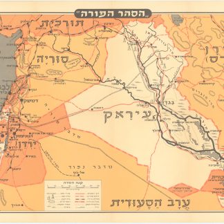
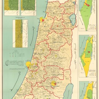
Political and demographic map of Palestine
Kharitah Filastin Bayna al-Intidab wa al-Intihab [Map of Palestine Between the Mandate and the Invasion].
Colour-printed map, 715 x 1195 mm, folded. In Arabic. Scale: 1:250,000.
€ 500.00
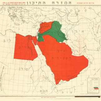
A political and demographic map of Palestine from the 1960s, showing the Arab and Jewish population living in Palestine before the mandate and after the occupation, prepared by the Egyptian geography professor Muhammad Mahmoud Al-Sayyad. The largest map is titled "Arab Palestine before the Nakba", depicting the majority of Muslim, Christian, Druze, and Jewish populations living in Palestinian villages. On the right side, there are three small maps (125 x 300 mm) showing the changing borders between 1937 to 1964 titled "1937 Partition Plan", "1947 Partition Plan of United Nations", and "The End of the Tragedy". On the left side, three infographics showing the proportion of Muslims and Jewish populations in 1920, 1948, and 1964.
An important map reflecting the tense Egyptian and Israeli relations leading up to the Six-Day War in 1967 and an Egyptian perspective on the occupation of Palestine.
Light wear to the edges, a few tears to the folds.
OCLC 1223284127 (dated "1970").