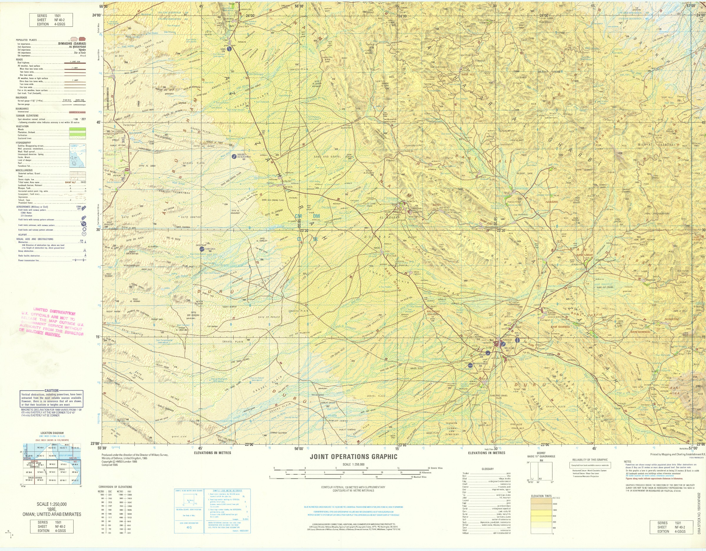
Limited distribution NATO maps of UAE, Oman, Saudi Arabia
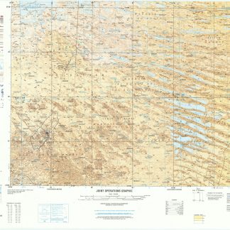
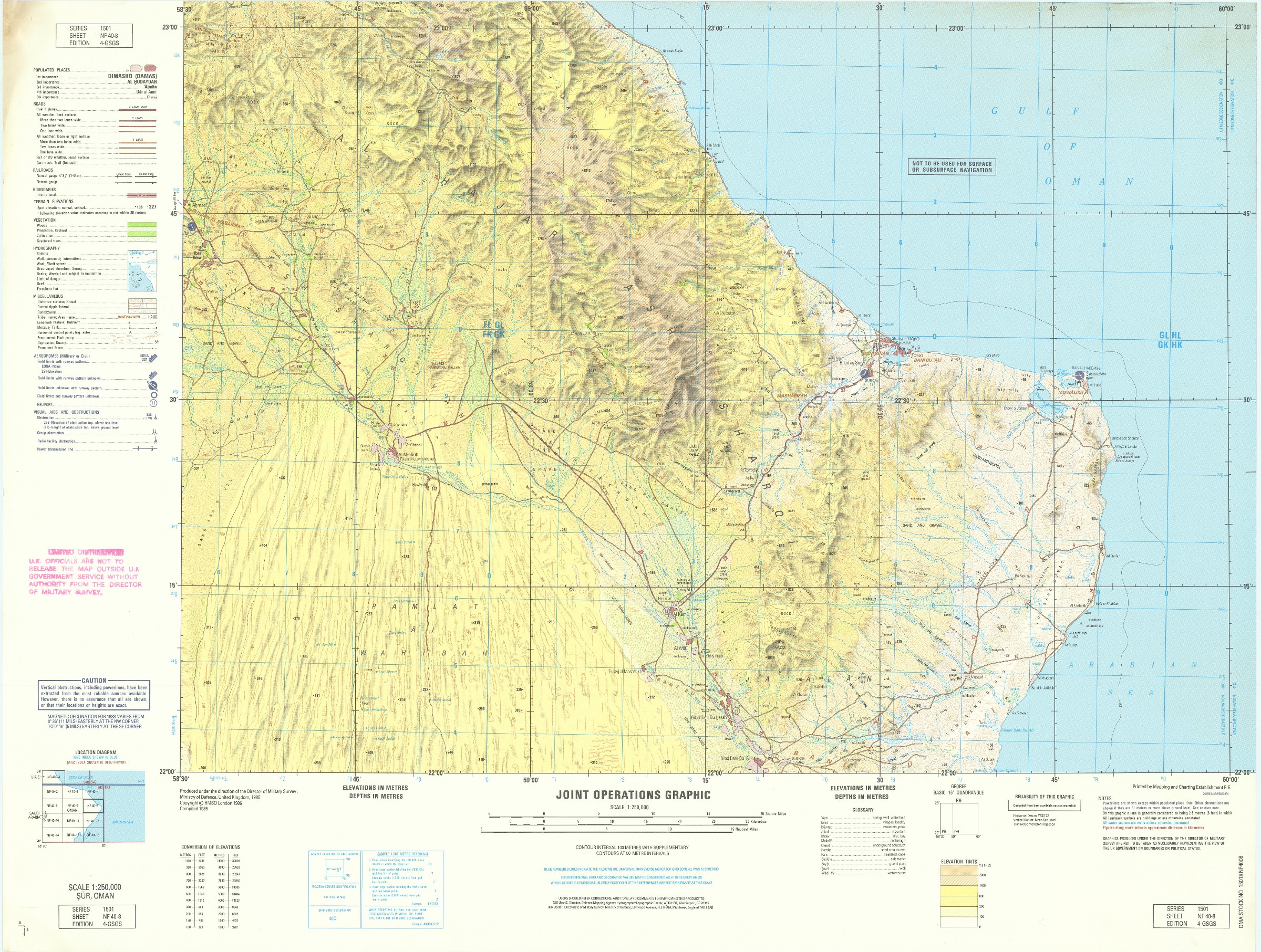
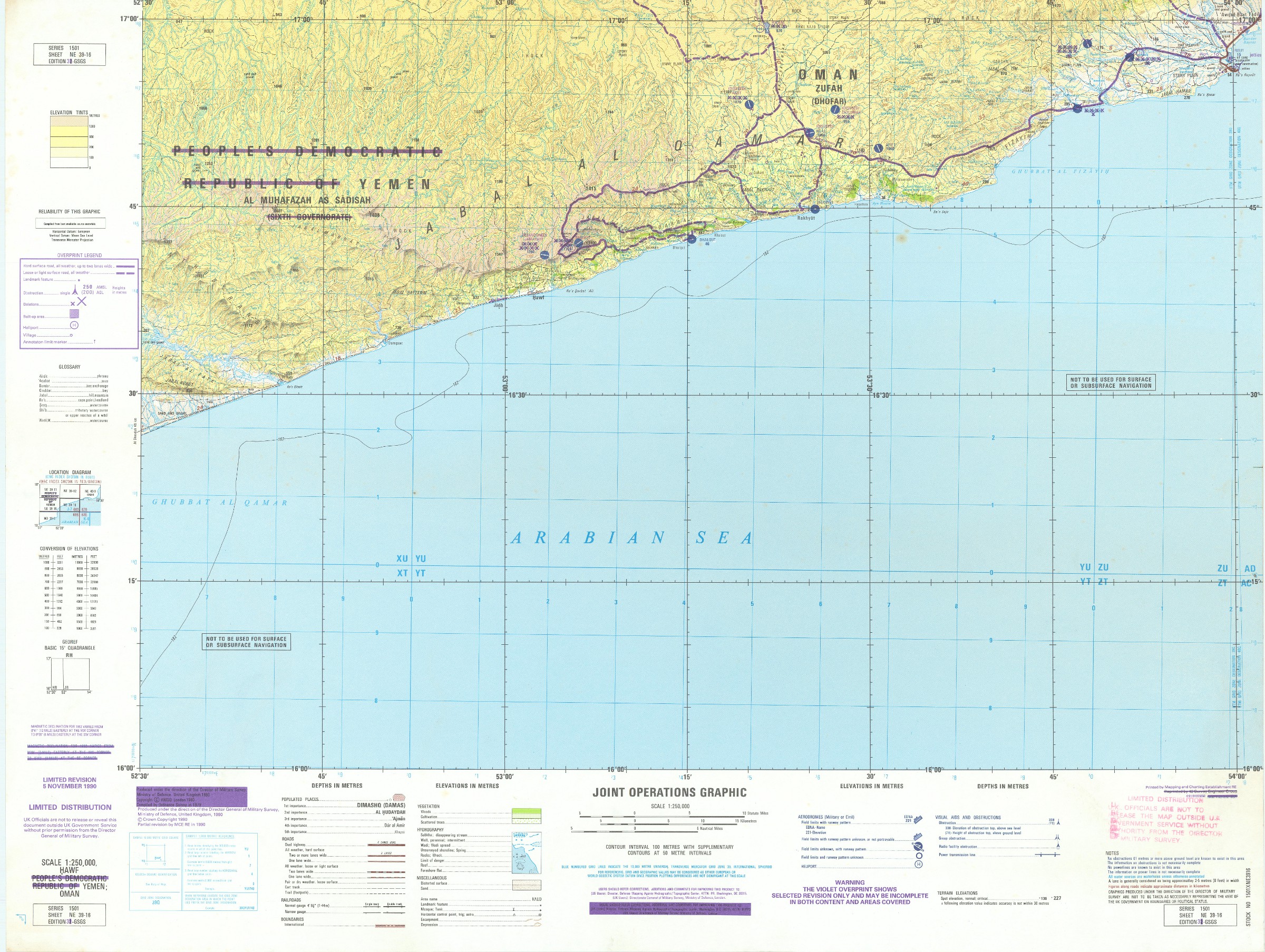
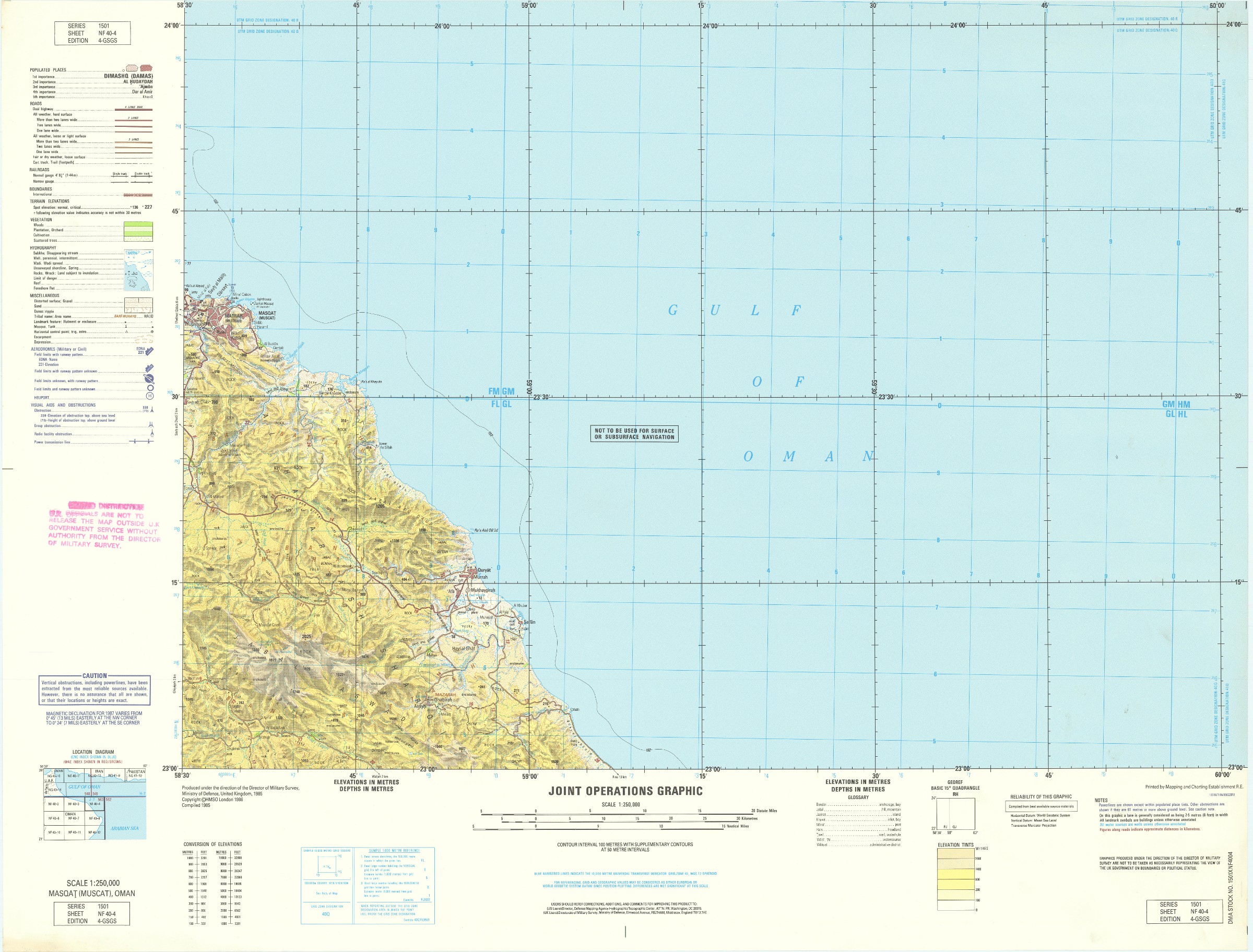
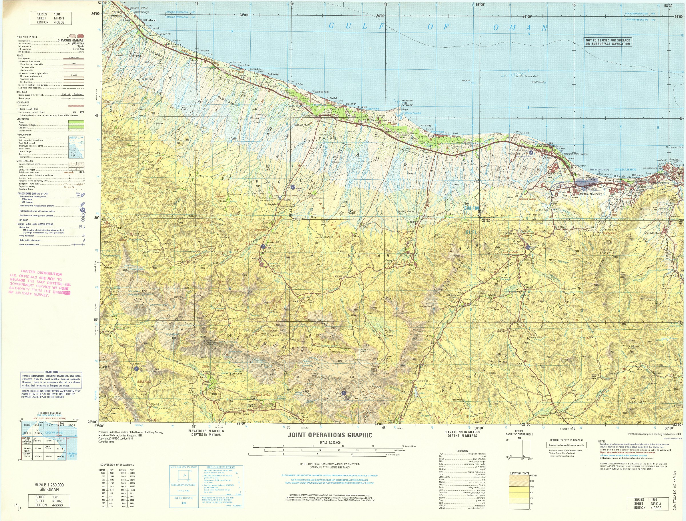
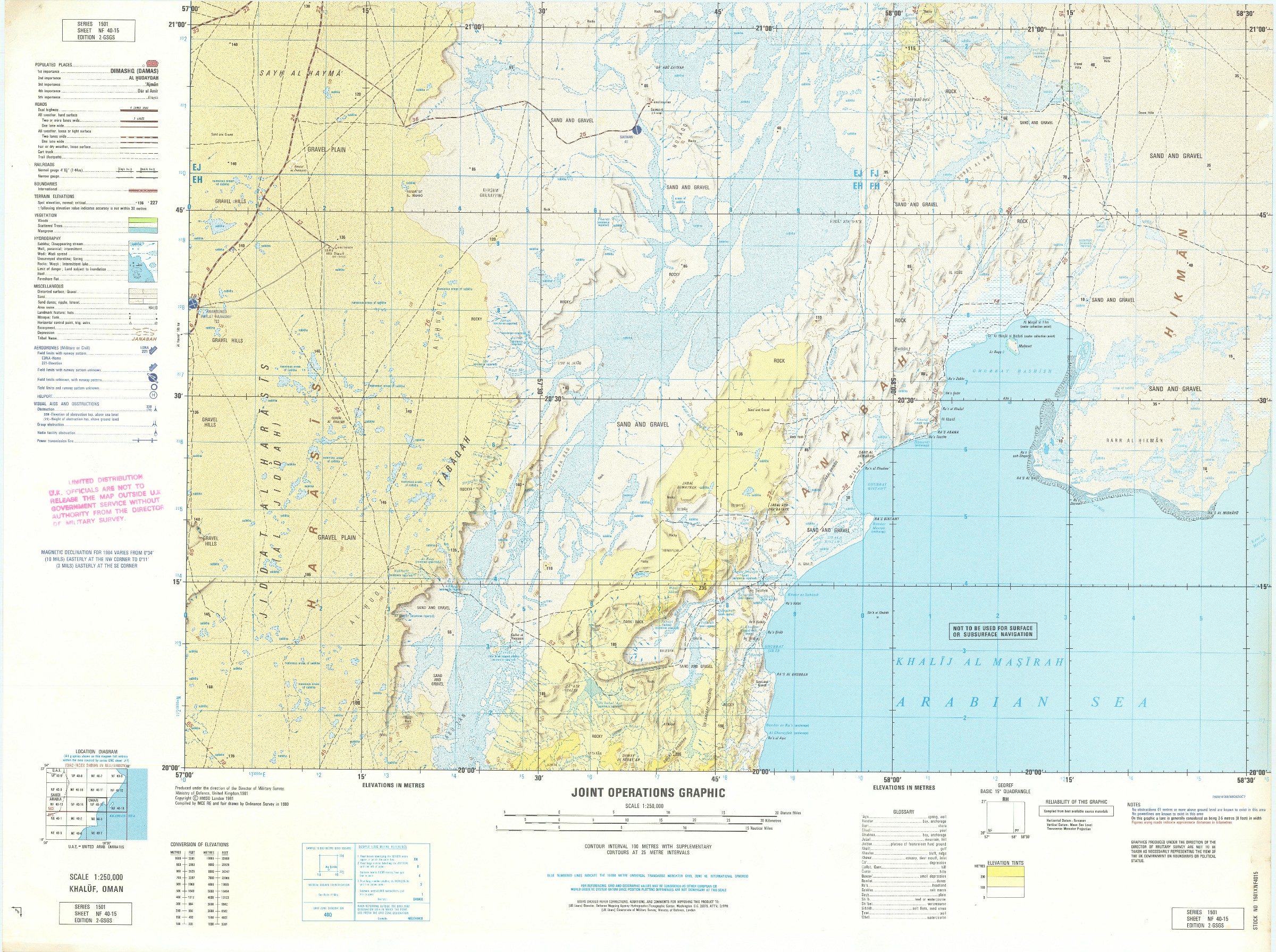
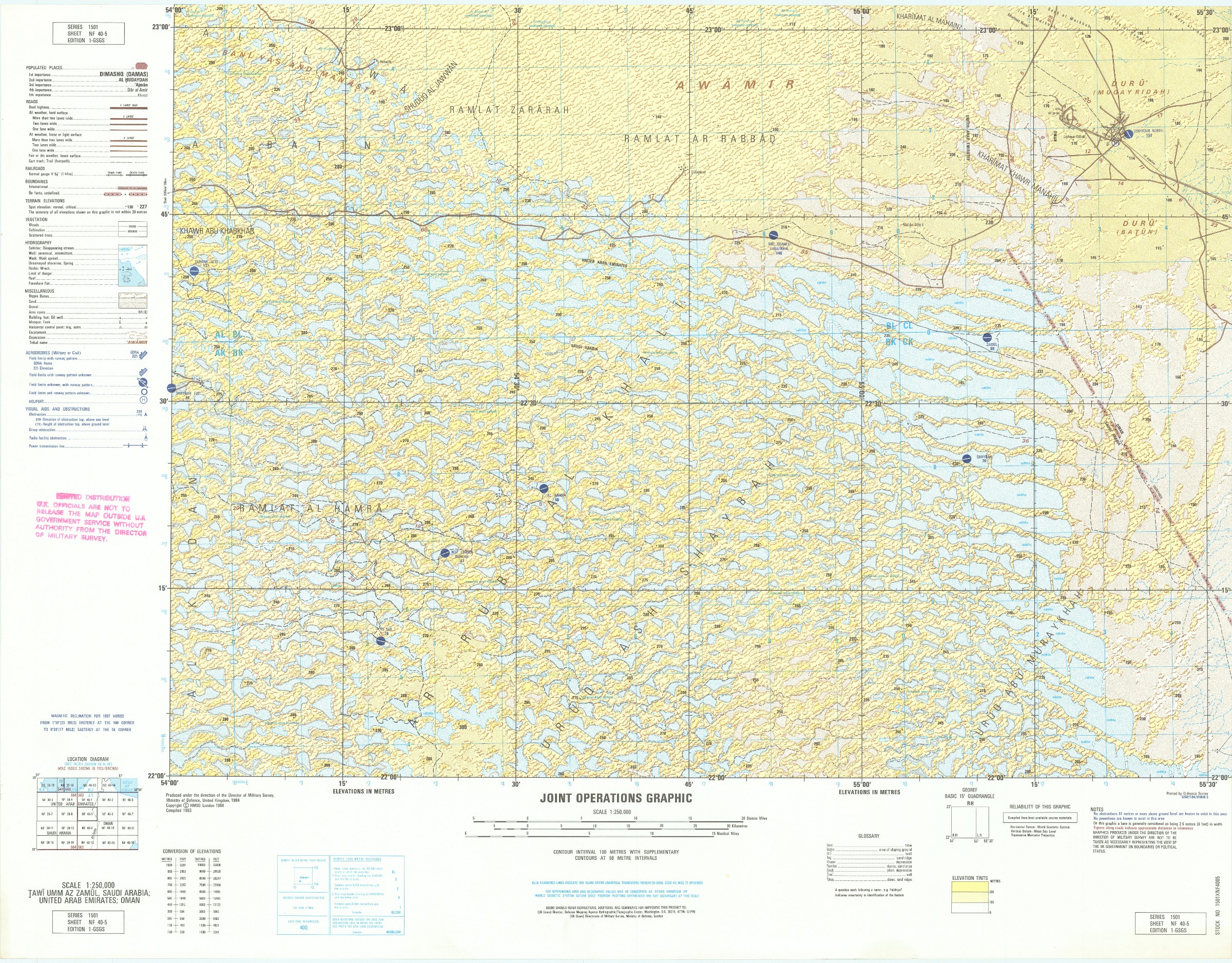
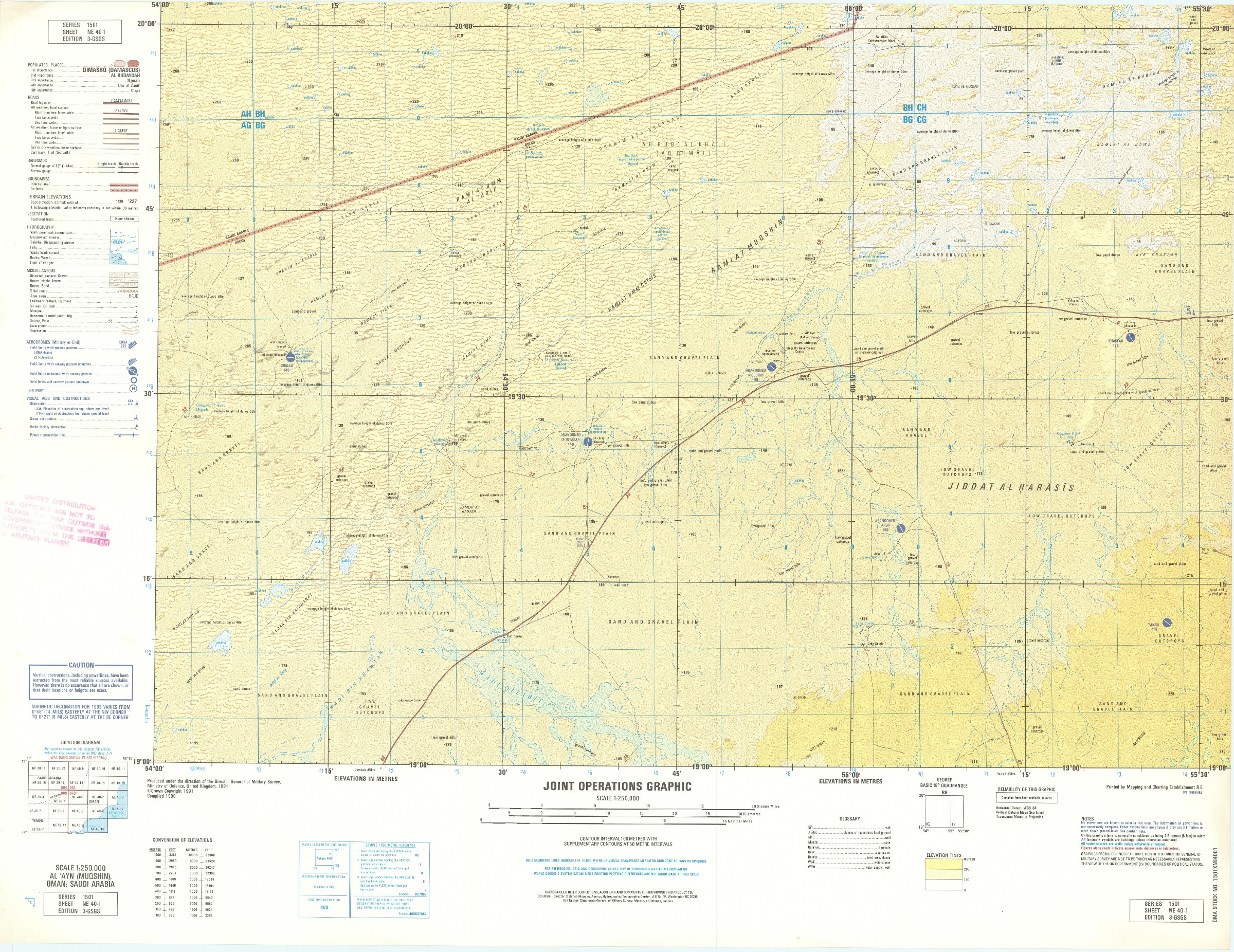
Joint Operations Graphic. Series 1501.
23 colour-printed maps (560 x 750 mm). Scale 1:250,000. Series 1501, editions 1-GSGS, 2-GSGS, 3-GSGS, and 4-GSGS. Comprises: NE-39-7, 16; NE-40-1-3, 5, 7, 9, 10; NF-40-1-8, 11-16.
€ 4,500.00
Twenty-three NATO military operations maps showing the UAE, Oman, Saudi Arabia, and Yemen. From 1965 onwards NATO adapted maps compiled by the United States and Great Britain into the Joint Operations Graphic series, designed for the use of NATO allies during military operations. Two versions were made: the 1501 series for ground operations, and the 1501A series for air operations. Though these twenty-three maps are labelled 1501, even they exhibit a large amount of information which is specifically relevant to air operations, including carefully marked landing fields and runways, with the directionality of the runway shown if the information was available. Notes are also presented on the presence of power lines in given areas, a very important risk for pilots landing in unknown and unofficial areas during wartime.
All major urban sites of Oman are shown, as are several oil fields of the Arabian Peninsula, including Lekhwair North oil field and airstrip, and an area of the UAE just south of Abu Dhabi noting two oil fields. Each map is stamped, "Limited distribution. UK officials are not to release the map outside UK government service without authority from the Director of Military Survey".
Slightest hint of wear, quite well preserved.
Related
-

Red Sea and Arabian Sea. ONC J-6/8. Operational navigation chart.St. Louis, Missouri, 1967 / 1975.
€ 3,000.00 -
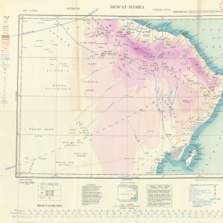
Asia 1:1,000,000. Muscat-Masira. NF-40.London, 1944.
€ 1,000.00 -
![Taqrir muqtarah an insha’ Quwwa Bahariyya li-Dawlat al-Bahrayn [Sketch proposal to build a Naval Force for the country of Bahrain].](https://inlibris.com/wp-content/uploads/2020/06/img-bn52212-324x324.jpg)
Taqrir muqtarah an insha’ Quwwa Bahariyya li-Dawlat al-Bahrayn [Sketch …Bahrain, mid-1970s.
€ 28,000.00 -
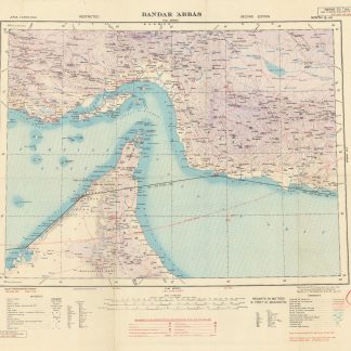
Asia 1:1,000,000. Bandar 'Abbas. Sheet North G-40.London, 1944.
€ 1,000.00