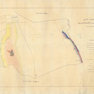
Original drawing of Al Ain geology
Manuscript map - [Town Planning Department Al Ain. Geological Survey of Al Ain Region].
Hand-drawn geological map in black felt tip marker, multicoloured marker, and coloured pencil. Titled and captioned in Arabic. Scale 1 : 50,000.
€ 7,500.00
One-of-a-kind hand-drawn geological map of Al Ain in ink and coloured pencil, drawn for the Al Ain Town Planning Department and captioned in tidy manuscript Arabic. Tracing the geology of Al Ain where the UAE meets the Omani border, the map was very likely sketched in the first years after the formation of the Union. Prominent in the drawing is the only mountain in the Emirate of Abu Dhabi, Jebel Hafeet, with its elevations carefully sketched in shades of colored pencil. Also notable is a ridge which partly defines the North-South border with Oman, identified by the cartographer as the remains of an ancient reef.
The Al Ain region and Jebel Hafeet are of great historical and environmental importance to the United Arab Emirates, and the Emirate of Abu Dhabi in particular. The mountain is the site of at least one ancient ruin: an example of the "beehive tombs" found in the region, and serves as a tourist destination and wildlife area with a unique geological history.
Lightly smudged and with a few closed tears expertly repaired.
Related
-
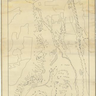
Geomorphological Map of Northern Part of Gabal Hafeet (U.A.E.).Abu Dhabi, 1970s.
€ 12,500.00 -
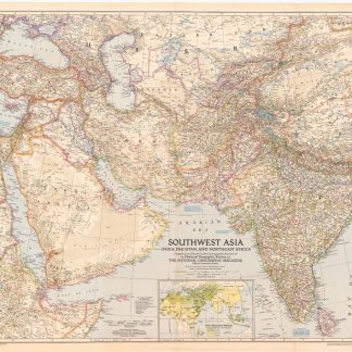
Southwest Asia, India, Pakistan, and Northeast Africa.Washington, DC, 1952.
€ 850.00 -

Carte de l’Empire Ottoman comprenant les possessions de la Porte en Europe, …Paris, 1825.
€ 3,000.00 -
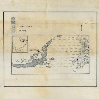
Geological map of Abu Dhabi.Abu Dhabi, 1970s.
€ 3,500.00