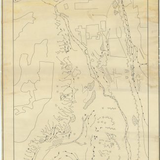
Original cartographic sketch of Abu Dhabi's lone mountain
Geomorphological Map of Northern Part of Gabal Hafeet (U.A.E.).
Manuscript map, 940 x 587 mm. Black ink on tracing paper.
€ 12,500.00
Drawn by hand: a geological map of the northern ridge of the only mountain in the Emirate of Abu Dhabi, traced carefully from aerial photographs commonly used as reference. Small corrections are visible where the cartographer, for example, narrowed a windgap, or slightly altered the position of a rock cut terrace in shale. A fascinating glimpse at the process of cartography, and the mapping of one of the most interesting geological zones in Abu Dhabi.
The lone mountain of Jebel (or Gabal) Hafeet lies exactly on the border with Oman and extends into the Emirati city of Al Ain. This geological map sketches out the paths of old landslides, winding wadis, and the thrust of summits on the slopes of Jebel Hafeet. Integrating the nearby city of Al Ain, the map also carefully notes a few settled areas.
The Al Ain region and Jebel Hafeet are of great historical and environmental importance to the United Arab Emirates and the Emirate of Abu Dhabi in particular. The mountain is the site of at least one ancient ruin: an example of the "beehive tombs" found in the region, and serves as a tourist destination and wildlife area with a unique geological history; just across the border to the north is the Buraimi oasis, subject of land disputes in the 1970s.
A few minor closed tears or punctures, very subtly repaired.
Related
-
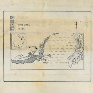
Geological map of Abu Dhabi.Abu Dhabi, 1970s.
€ 3,500.00 -
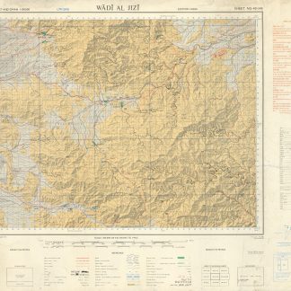
Trucial States, Muscat and Oman. Wadi Al Jizi. Series K668. Edition I-GSGS. …United Kingdom, 1967.
€ 2,800.00 -
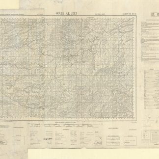
Trucial States, Muscat and Oman. Wadi Al Jizi. Series K668. Edition I-GSGS. …United Kingdom, 1967.
€ 2,000.00 -
Southwest Asia, India, Pakistan, and Northeast Africa.Washington, DC, 1952.
€ 850.00