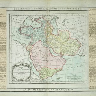
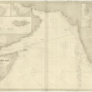
Arabian Sea. Chart No. 143. East Sheet.
Engraved blue-back nautical chart. 1090 x 1340 mm. 3 joined sheets. With yellow title-label mounted on the reverse.
€ 4,500.00
Very rare nautical chart of the coastline of the Arabian Sea, including an early depiction of the Emirates with Abu Dhabi, Sharjah and Dubai labelled. The map further shows Bahrain and Qatar, the Gulfs of Oman and Aden, and the coast of Africa all the way south beyond Mogadishu. To the east the map reaches beyond the Maldives, including the entire coast of Pakistan and India as well as a portion of Ceylon. Complete with compass roses and steamer routes from Aden to the Straits of Sunda.
With 3 inset maps of Bombay, Ras Asir and Socotra island.
From the collection of the Swedish sea captain Olof Peter Reinhold Olsson (1853-1921), a resident of Helsingborg.
Some small marginal flaws. Otherwise very well preserved.
Cf. OCLC: 45533994 (1875).