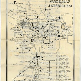
Plan of Jerusalem for the use of British soldiers
Guide Map of Jerusalem. PDR/MISC/3612 (15000).
276 x 376 mm.
€ 350.00
Detailed plan of Jerusalem for the use of British soldiers created by the Survey Directorate HQ, Palestine and Trans Jordan. It shows Jerusalem bounded by the Old City, Records Office, and Allenby Barracks and Government House. Many features are named including hotels, cafes and restaurants, the Jewish Agency, police and military installations (Navy, Army and Air Force Institutes), military courts, detention and other barracks, Survey Map and Stationery Depots, guarded car parks, clubs, recreation and culture facilities, hospitals, Medical Inspection (M.I.) Room, as well as banks, busses and railway stations.
The verso provides updated information "for the guidance of all members of the Forces visiting Jerusalem" including reporting, arms and ammunition, accommodation, valuables, clubs, medical facilities, taxi fares, guides etc.
Slightly spotted.
OCLC 429178532.
Related
-
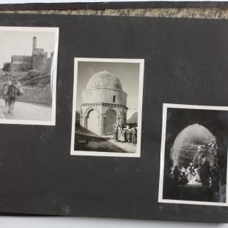
Photograph album of British Mandate Palestine.Mandate Palestine, ca. 1946.
€ 2,800.00 -
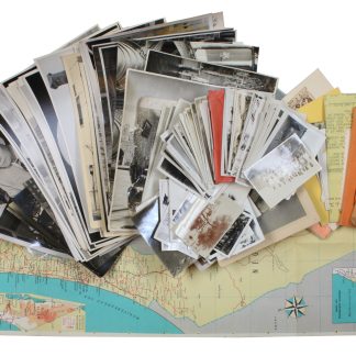
[Photograph archive - thirty years of R.A.F. tours].Yemen, Israel, Palestine, Egypt, 1920s-1950s.
€ 3,500.00 -
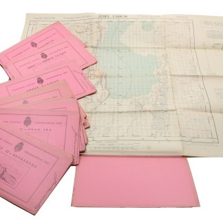
Palestine Survey Maps.Jerusalem?, 1942-1945.
€ 6,500.00 -
[Shanah be-Yisrael 708-709. Parashat ha-shanah bi-temunot]. A Year in Israel …Tel-Aviv, 1949 CE = 5709.
€ 450.00