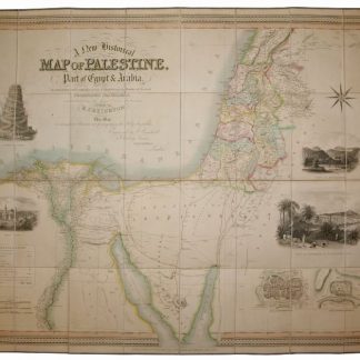
A New Historical Map of Palestine, With Part of Egypt & Arabia. Ancient & Modern Geography of those Countries with the Routes of Several Celebrated Travellers.
London, William Colling Hobson, 1833.
Large hand-coloured folding engraved map (ca. 103 x 82 cm). Scale ca. 1:1,000,000. In contemporary red morocco slipcase.
€ 1,500.00
Rare 1833 edition of a historical map of Palestine, with a part of Egypt and Arabia. This map is of particular interest for showing the principal roads and travel routes through the desert, with the old Roman road and the route of the Hajj, as well as the route taken by Eyles Irwin in 1777. Occasional browning; slipcase rubbed and bumped, but well preserved on the whole.
References
Cf. Röhricht (Palästina) 633 (London, 1831). Laor, Maps of the Holy Land (1839 edition). Not in Al Ankary or Al-Qasimi.
Related
-
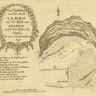
Begebenheiten einer Reise auf dem rothen Meer, auf der arabischen und ägyptischen …Leipzig, 1781.
€ 1,800.00 -

Voyage en Arabie & en d'autres Pays circonvoisins. Tome premier (-second). …Amsterdam & Utrecht, 1775-1780.
€ 6,000.00 -
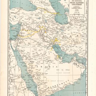
Arabia and near bordering countries. Includes: Palestine, Iran (Persia) …Chicago, ca. 1936-1941.
€ 1,500.00 -
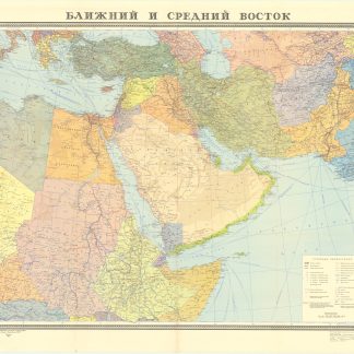
Blizhnij i srednij vostok.Moscow, 1972.
€ 400.00