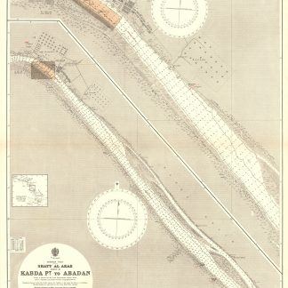
Persian Gulf. Shatt Al Arab [5 sheets].
Sheet 1: 1030 x 700 mm; sheet 2: 1220 x 710 mm; sheet 3: 1030 x 700 mm; sheet 4: 1030 x 700 mm; sheet 5: 1220 x 710 mm. Scale 1:25,000.
$3,805.00
Nautical chart of Shatt Al Arab on 5 sheets: sheet 1 showing the "Entrance to Shatt Al Arab", sheet 2 showing the "Inner Bar to Kabda Point", sheet 3 showing "Kabda Point to Abadan" with an inset map of Abadan, sheet 4 showing "Abadan to Tuwaila Island" with an inset map of Mohammerah Bar, and sheet 5 showing "Tuwaila Island to Coal Island" with an inset map of Basra and Ma'qil. Engraved chart, including tidal information, compass roses, soundings, seabed notations, currents, sandbanks, shoals, lighthouses and beacons picked out in yellow and red, inland elevations, detailing and buildings. First published in 1907, revised in 1932. Signs of contemporary use, with several pencil markings. Folded.
Related
-

Carte de l’Empire Ottoman comprenant les possessions de la Porte en Europe, …Paris, 1825.
$3,262.00 -

Iran (Persia) and Iraq.London, 1930s.
$707.00 -
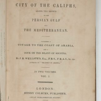
Travels to the City of the Caliphs, along the Shores of the Persian Gulf …London, 1840.
$6,524.00 -
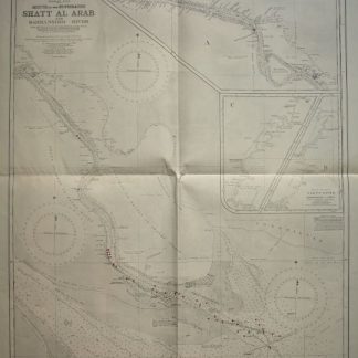
Persian Gulf. Mouth of the Euphrates. Shatt Al Arab and Bahmanshir River. …London, 1944.
$1,631.00