
General'nyí shtab. Medina. G-37. (And:) Al-Wajh. G-37-A. (And:) Madain-Salih. G-37-VIII. Al-Ula. G-37-XIV.
4 topographic maps, colour-printed. 70 x 58 cm (1:1,000,000), 66 x 55.5 cm (1:500,000), ca. 54 x 45 cm (1:200,000). Constant ratio linear horizontal scale. In Russian (Cyrillic).
€ 4,500.00
The Soviet Union's 1:1,000,000, 1:500,000, and 1:200,000 General Staff map quadrangles showing Al-`Ula: from the Russian series of military maps produced during the Cold War, based on high-quality satellite imagery, but usually also ground reconnaissance. The information was compiled during the years 1982, 1967-70, and 1972-75; the editors were V. R. Iost, Ju. V. Chekusov, and N. D. Yarema, respectively. The smaller-scale maps cover the northwestern coastal portion of the Arabian Peninsula, the large-scale maps provides an astonishing degree of detail. The oasis town Al-`Ula, on the historical Incense Road, is depicted in the Wadi Al-'Ula; nearby landmarks include the Jabal al Mijdar, Khuraybah, and Bi'r 'Udhayb.
Products of a massive, clandestine cartographic project begun under Stalin and ultimately encompassing the entire globe, the Soviet General Staff maps are today noted for their extreme precision. Indeed, even in post-Soviet times they provide the most reliable mapping for many remoter parts of the world: "Soviet-era military maps were so good that when the United States first invaded Afghanistan in late 2001, American pilots relied on old Russian maps of Afghanistan. For almost a month after the United States began a bombing campaign to help oust the Taliban government, American pilots were guided by Russian maps dating back to the Soviet occupation of Afghanistan in the 1980s" (Davies/Kent, p. xi).
Although the details of the cartographic programme evolved over the decades, its overall system and plan remained remarkably constant. "The basic quadrangle is the 1:1,000,000 sheet spanning 4° latitude by 6° longitude. The quadrangles are identified by lettered bands north from the equator and by numbered zones east from longitude 180° [...] Each 1:1,000,000 sheet is subdivided into four 1:500,000 sheets (from northwest to southeast), labeled [by] the first four letters of the Russian alphabet [...] Each 1:1,000,000 sheet is [also] subdivided into 36 1:200,000 sheets in a six-by-six grid [... They] normally contain on the reverse side a detailed written description of the districts (towns, communications, topography, geology, hydrology, vegetation, and climate) together with a geological sketch map" (ibid., p. 19-21). "Printing such large-format plans in so many colors with near-perfect print registration itself testifies to the skill of the printers in the military map printing factories across the former Soviet Union. The quality of printing reflects the level of training and the reliability of humidity-control equipment and the electricity supply at the time" (ibid., p. 6f.). The 1:200,000-scale maps are specifically labelled "For Offical Use". Although the general terrain evaluation maps and operational maps produced at the smaller scales of 1:1,000,000 and 1:500,000 were not separately marked as classified, all General Staff maps de facto constituted closely guarded military material, none of which became available in the West before the end of the Cold War in the early 1990s.
Light traces of folds; some very insignificant wrinkling in places, but altogether in excellent condition.
Cf. J. Davies / A. J. Kent, The Red Atlas (Chicago/London, 2017).
Related
-
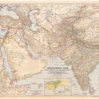
Southwest Asia, India, Pakistan, and Northeast Africa.Washington, DC, 1952.
€ 850.00 -
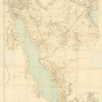
Arabia and the Persian Gulf. N.W. Section, S.W. Section. [Map of Arabia …Dehra Dun, 1916.
€ 8,500.00 -
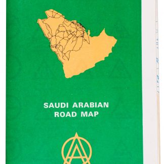
Saudi Arabian road map.Dammam, 1975.
€ 1,350.00 -
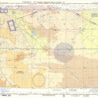
USAF aeronautical chart and information service. World aeronautical chart …Washington, DC, 1958.
€ 950.00
