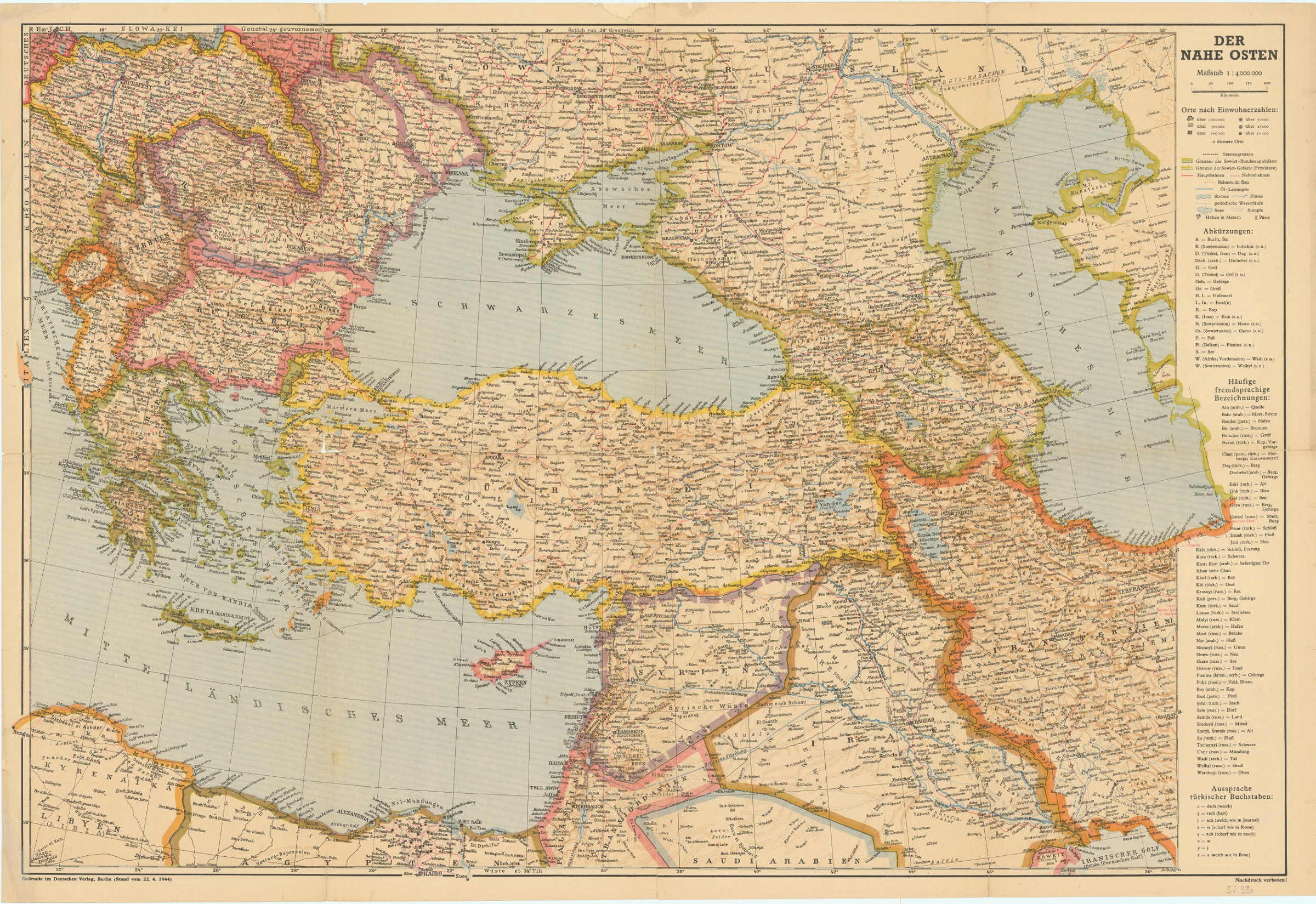
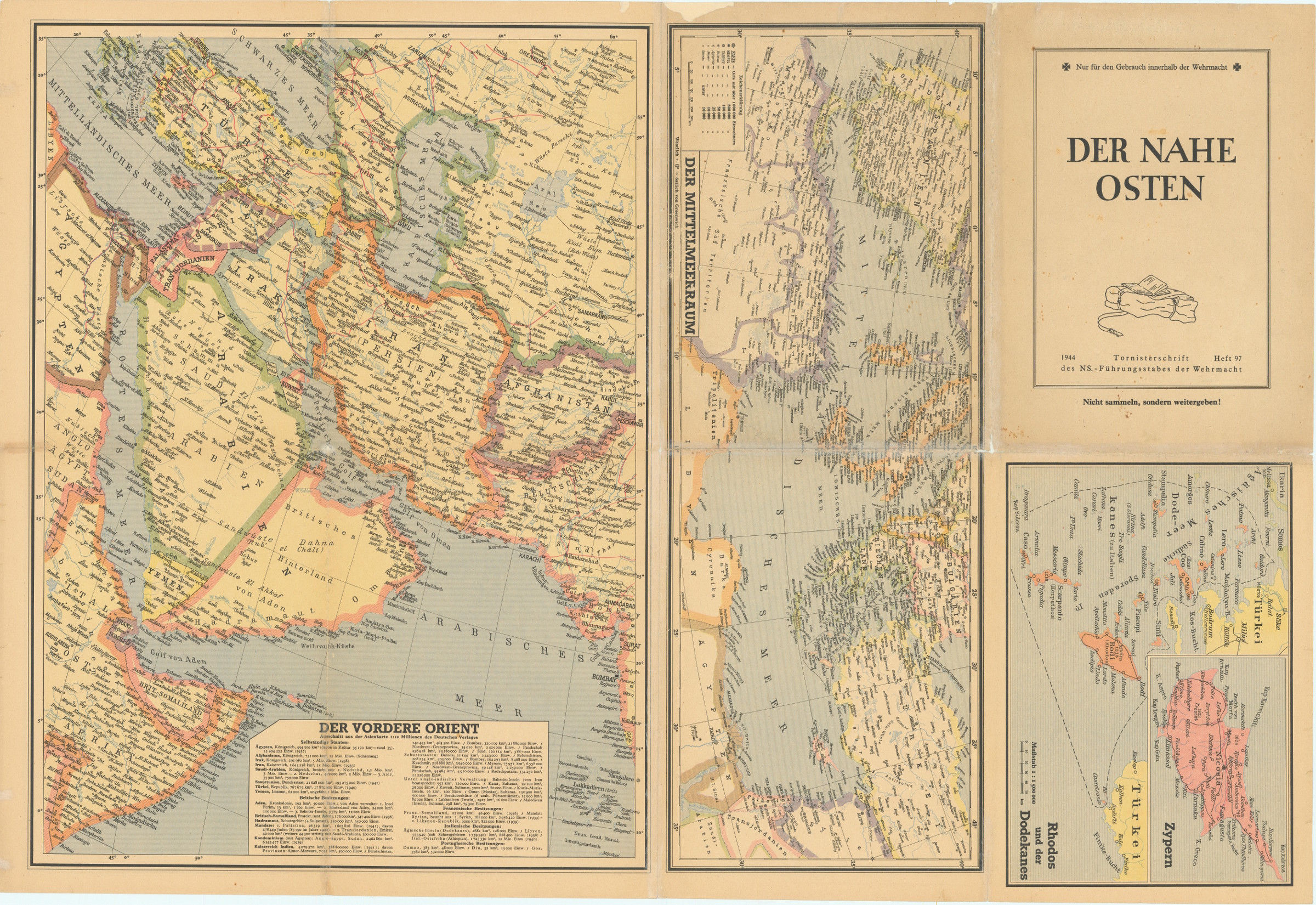
Der Nahe Osten. Tornisterschrift des NS.-Führungsstabes der Wehrmacht. Heft 97.
580 x 850 mm. 1 topographic and 4 political colour-printed folding maps on one sheet. Scale: 1:4,000,000; 1:10,000,000; 1:1,500,000.
€ 350.00
Published by the German Wehrmacht for use in the field: a large map of Asia Minor, reaching from Eastern Europe in the west to Iran in the east, showing the whole of Turkey, parts of Russia, the Caspian Sea, and the far north of the Arabian Gulf, identifying Kuwait city. The northern parts of Libya, Egypt, and Palestine are visible, including cities such as Cairo, Jerusalem, Jaffa, and Tel-Aviv. The furthest point to the west is the Italian town of Brindisi. The captions include translations of common Arabic, Persian, Russian and Turkish geographical terms into German, as well as instructions for the pronunciation of Turkish letters.
Smaller maps of the Gulf, including parts of Russia and India, as well as of the Mediterranean, Rhodes and the Dodecanese, and Cyprus verso.
Very well preserved.
Cf. Biester/Wurm, Archiv für Geschichte des Buchwesens Bd. 70, 196.