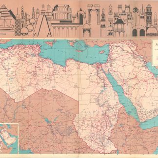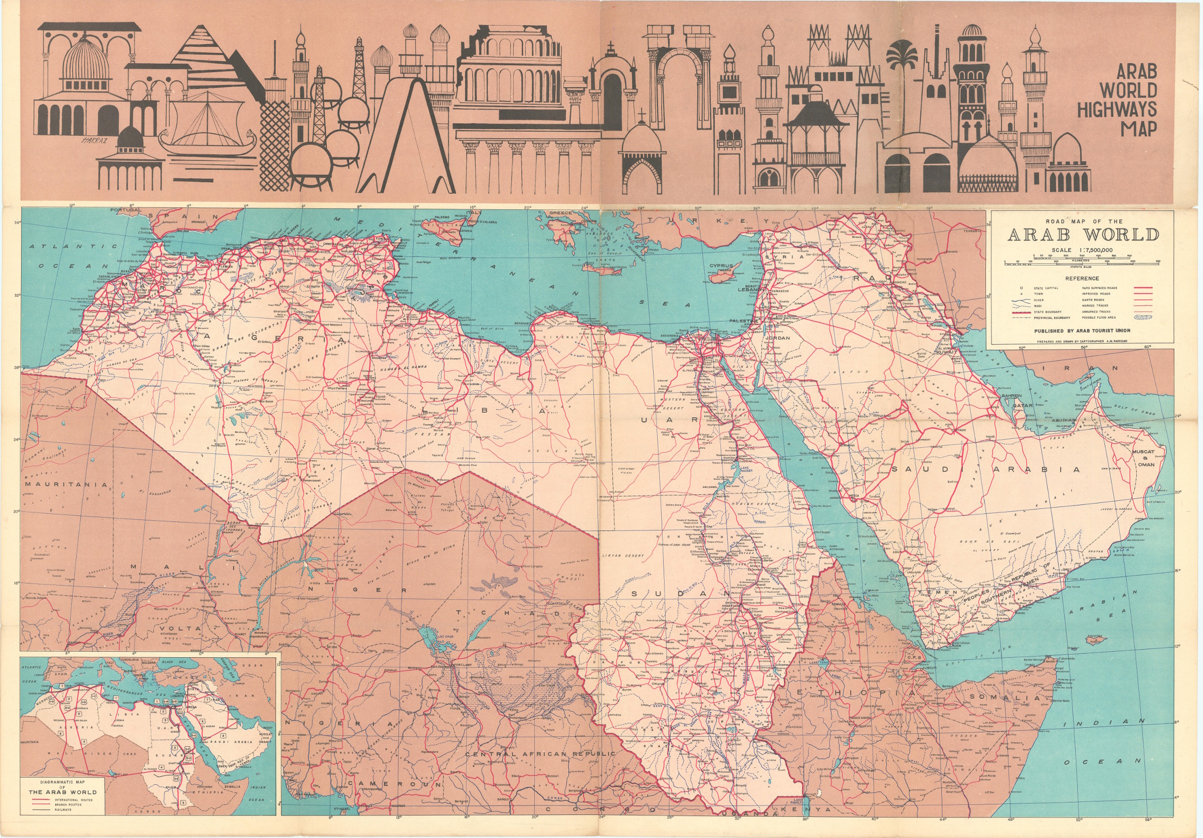
Road Map of the Arab World
Arab World Highways Map. Road Map of the Arab World.
42 x 100 cm. Five-tone lithographic map with illustration by Harraz. Constant ratio linear horizontal scale 1:7,500,000. Road map also showing railways, populated places, boundaries, rivers, wadis, and possible flood areas. Includes inset map: Diagrammatic map of the Arab world. Folded.
€ 1,250.00
First edition of this large, decorative map, showing the highways that linked countries under Arabian influence in the early 1970s. It stretches as far north as Turkey, south to the Sudan, west to Mauritana and east beyond the Strait of Hormuz, capturing the whole of the Arabian Gulf including Kuwait, Bahrain, Muscat, Oman, Saudi Arabia and the People's Republic of Southern Yemen. The verso contains an index of main travel routes through these various countries.
The United Arab Republic, as it is here referred to, was formed through a political union of Egypt and Syria. It was instigated by the Egyptian Prime Minister Gamal Abdel Nasser (1918-1970) and was seen as an expression of pan-Arab sentiment. Syria broke aways from the union in 1961 (and is here shown as an independent country), but Egypt continued to use the name until 1972. The People's Republic of Yemen, the only communist state to be established in the Arab world, was formed in late 1967, to last until 1990.
Some nicks and small tears, a single mark to the covers, a 1 cm tear on the left side of the map. In very good condition for a fragile map. Scarce: LibraryHub does not locate any holdings whilst Worldcat adds just eight institutional copies worldwide.
OCLC 5403988.
Related
-

Carte de l’Empire Ottoman comprenant les possessions de la Porte en Europe, …Paris, 1825.
€ 3,000.00 -
Itinerario de Ludovico de Verthema Bolognese ne lo Egypto ne la Suria ne …Milan, 30 April 1523.
€ 125,000.00 -
![Die Ritterlich und lobwürdig reiß [...] Sagend von den landen, Egypto, Syria, von beiden Arabia Persia, India und Ethiopia, von den gestalten, sitten, und dero menschen leben und glauben.](https://inlibris.com/wp-content/uploads/2020/04/img-bn33502-324x324.jpg)
Die Ritterlich und lobwürdig reiß [...] Sagend von den landen, Egypto, …Strasbourg, 1516.
€ 450,000.00 -
Documents sur l'histoire, la géographie et le commerce de l'Afrique orientale.Paris, 1856-1857.
€ 35,000.00