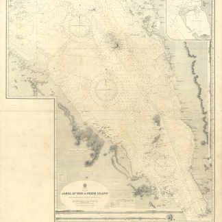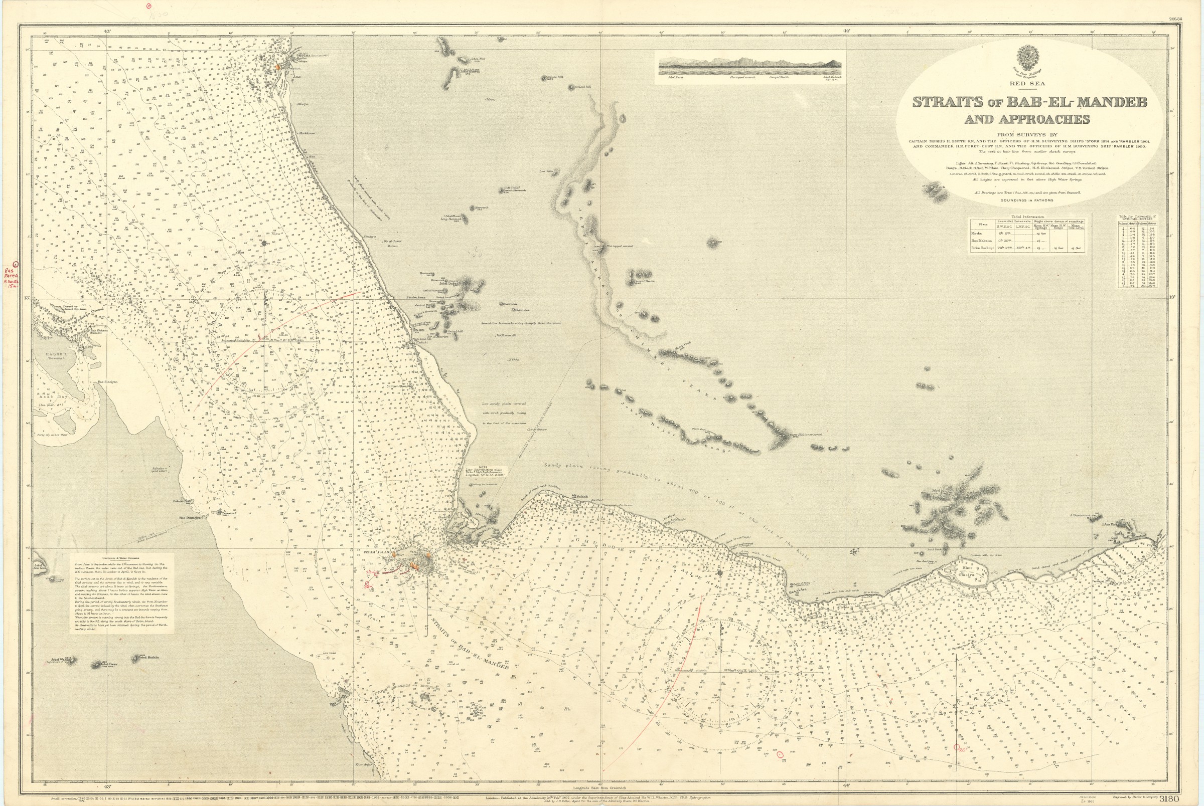
Straits of Bab-el-Mandeb and Approaches. No. 3180.
Standard issue, 700 x 1024 mm. Scale 1:175,000 approx.
€ 800.00
Nautical chart of a small portion of the Red Sea, the Bab-el-Mandeb Strait, prepared by the British Admiralty. It shows Perim Island and Halib Island, as well as Mokka as its northernmost city. Other notable places include Ras al Ara, Ras Bab-el-Mandeb, Khor Omeira, and the Jezirat Sowabih islands. The chart pays particular attention to geological features, labelling larger and smaller hills including the Jebel Arrar or Chimney Peaks, as well as dunes and sandy plains.
The British Admiralty has produced nautical charts since 1795 under the auspices of the United Kingdom Hydrographic Office (HO). Its main task was to provide the Royal Navy with navigational products and service, but since 1821 it has also sold charts to the public. The present chart was composed after Admiralty surveys of 1891, 1900 and 1901; it was first published in 1902 and saw several corrections up to 1936.
With a single fold. A few manuscript notes. Captioned in print and in a former collector's hand on verso.
![Indian Ocean - Northern Portion [Admiralty Chart No 748b].](https://inlibris.com/wp-content/uploads/2023/10/img-bn33603-324x324.jpg)