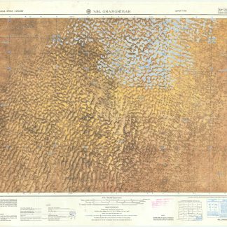
Abl Ghamghimah. Series K 502, Sheet NE 39-4, Edition 1-AMS.
Washington, D.C., Army Map Service, 1965.
Folding map. Ca. 755 x 570 mm. Scale 1:250,000.
€ 500.00
Military geological map of 'Abl Ghamghimah in the Eastern Province of Saudi Arabia. Prepared by the U.S. Army after aerial photography in December 1954 and January/February 1955. Reprinted for the UK Ministry of Defence with their stamp: "Limited distribution. U.K. officials are not to release the map outside government service". The chart details the average relative heights of sand dunes as well as sabkhas and water wells.
Occasional light browning.
Related
-
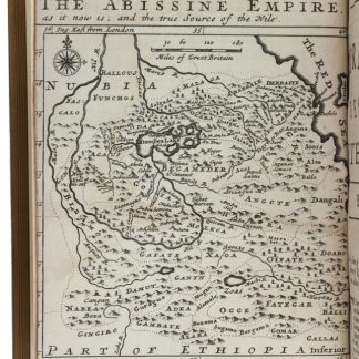
The travels of the Jesuits in Ethiopia: containing [...] travels in Arabia …London, 1710.
€ 25,000.00 -
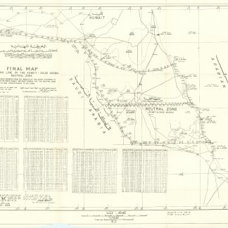
Final map of dividing line of the Kuwait - Saudi Arabia Neutral Zone.N. p., August 1968.
€ 3,500.00 -

Reize naar Arabië en andere omliggende landen.Amsterdam & Utrecht, 1776-1780.
€ 6,000.00 -

La Mer Rouge, l'Abyssinie et l'Arabie. Tome 2: Les guerres du poivre. Les …Cairo, 1935.
€ 850.00