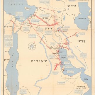
Arab League oil map
Map of Arabian Oil. Kharitat al-batrul al-Arabi.
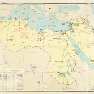
Colour-printed map, 690 x 1110 mm. Text and captions in English and Arabic.
€ 6,500.00
Rare map issued by the Department of Petroleum Affairs at the League of Arab States which, printed in bright colour, illustrating the distribution of oilfields, pipelines, refineries and exploration wells throughout the Gulf States, Saudi Arabia and North Africa. The extensive oil fields of Saudi Arabia and the UAE are particularly visible, and taken as a whole, the map provides a snapshot of Arab oil production and industry in the early 1960s. With three inset maps ("Qatar and Bahrein", "Eastern Desert and Sinai Peninsula" and the coast of Saudi Arabia and Kuwait), a table listing "Crude Oil Production (1962 in Barrels)" and an index of terms.
The map was produced by the Arab League in roughly 1963; the League, though a political rather than an oil-industry coalition, includes all the members of the Organization of Arab Petroleum Exporting Countries (OAPEC). Petroleum was, and remains, one of its foremost economic concerns.
Small closed tears in blank margins, otherwise bright and clean.