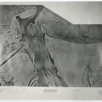
Detailed aerial photography of the city of Abu Dhabi in 1976
Complete set of 6 Aerial Surveying Photographs (nos. 1-6). Abu Dhabi Sadiyat.
6 black and white aerial photographs, 213 x 260 mm. Scale approx. 1:10,000. Each photograph numbered, and may be arranged into a tiled layout. Stored in custom-made black card portfolio.
€ 12,500.00
A complete set of aerial photographs showing the city of Abu Dhabi, Zayed Port, the neighbouring islands of Saadiyat, Al Reem, and Umm Yifenah, and the north-western tip of what is now Jubail Mangrove Park.
Completed by Hunting Geological Surveys in 1976 and subsequently published, these photos show a remarkably detailed bird's-eye view of Abu Dhabi in the pivotal first few years after the formation of the United Arab Emirates. Visible is the mid-century boom in infrastructure in Abu Dhabi itself, with seaports and Abu Dhabi International Airport (today Al Bateen Executive Airport), streets, highways, and even Khalidya Park. Saadiyat Island, now a centre for the arts and culture, as well as a resort area, shows only the first signs of development. Canals and shipping lanes are just beginning to take shape across the islands to the east of Abu Dhabi itself.
Two small closed tears, a few hints of wear; in good condition. Taken altogether, a fascinating snapshot of Abu Dhabi in 1976.
Related
-
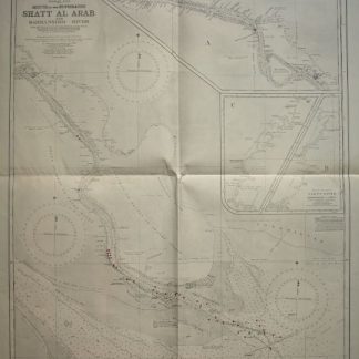
Persian Gulf. Mouth of the Euphrates. Shatt Al Arab and Bahmanshir River. …London, 1944.
€ 1,500.00 -

Voyage en Arabie & en d'autres Pays circonvoisins. Tome premier (-second). …Amsterdam & Utrecht, 1775-1780.
€ 6,000.00 -
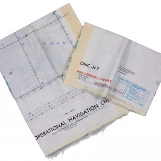
Persian Gulf. ONC-H-6/7. Operational navigation chart.St. Louis, 1969.
€ 2,800.00 -
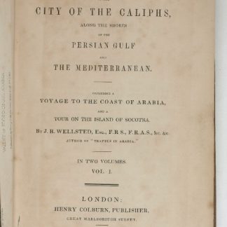
Travels to the City of the Caliphs, along the Shores of the Persian Gulf …London, 1840.
€ 6,000.00