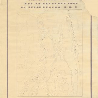
Studying the only mountain in Abu Dhabi
Geomorphological map of northern part of Jabal Hafeet, U.A.E.
Black and white photoprinted map made from a manuscript original, 1020 x 763 mm.
€ 7,500.00
A scarce map of the northern ridge of the only mountain in the Emirate of Abu Dhabi, reproduced in likely a very limited run from a hand-drawn original. The lone mountain of Jebel (or Jabal) Hafeet lies exactly on the border with Oman and extends into the Emirati city of Al Ain. This geological map sketches out the thrusts of various strata, flood plain terraces, scree slopes, and dunes. Integrating the nearby city of Al Ain, it also carefully notes settled areas and areas where the geology of the mountain has been altered by human engineering works. The Al Ain region, and Jebel Hafeet in particular are of great historical, and environmental importance to the United Arab Emirates and the Emirate of Abu Dhabi in particular. The mountain is the site of at least one ancient ruin: an example of the "beehive tombs" found in the region, and serves as a tourist destination and wildlife area.
With later manuscript notes rewriting the stylized title more legibly, and the name "Mahmood" in one margin. Some gentle wear, with chipped corners (no loss to text or map); reinforced and rebacked.
Related
-

Persian Gulf. ONC-H-6/7. Operational navigation chart.St. Louis, 1967.
€ 1,500.00 -
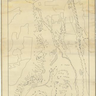
Geomorphological Map of Northern Part of Gabal Hafeet (U.A.E.).Abu Dhabi, 1970s.
€ 12,500.00 -
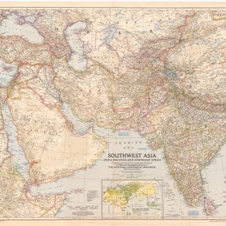
Southwest Asia, India, Pakistan, and Northeast Africa.Washington, DC, 1952.
€ 850.00 -
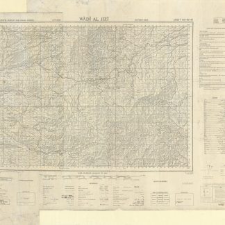
Trucial States, Muscat and Oman. Wadi Al Jizi. Series K668. Edition I-GSGS. …United Kingdom, 1967.
€ 2,000.00