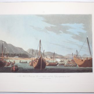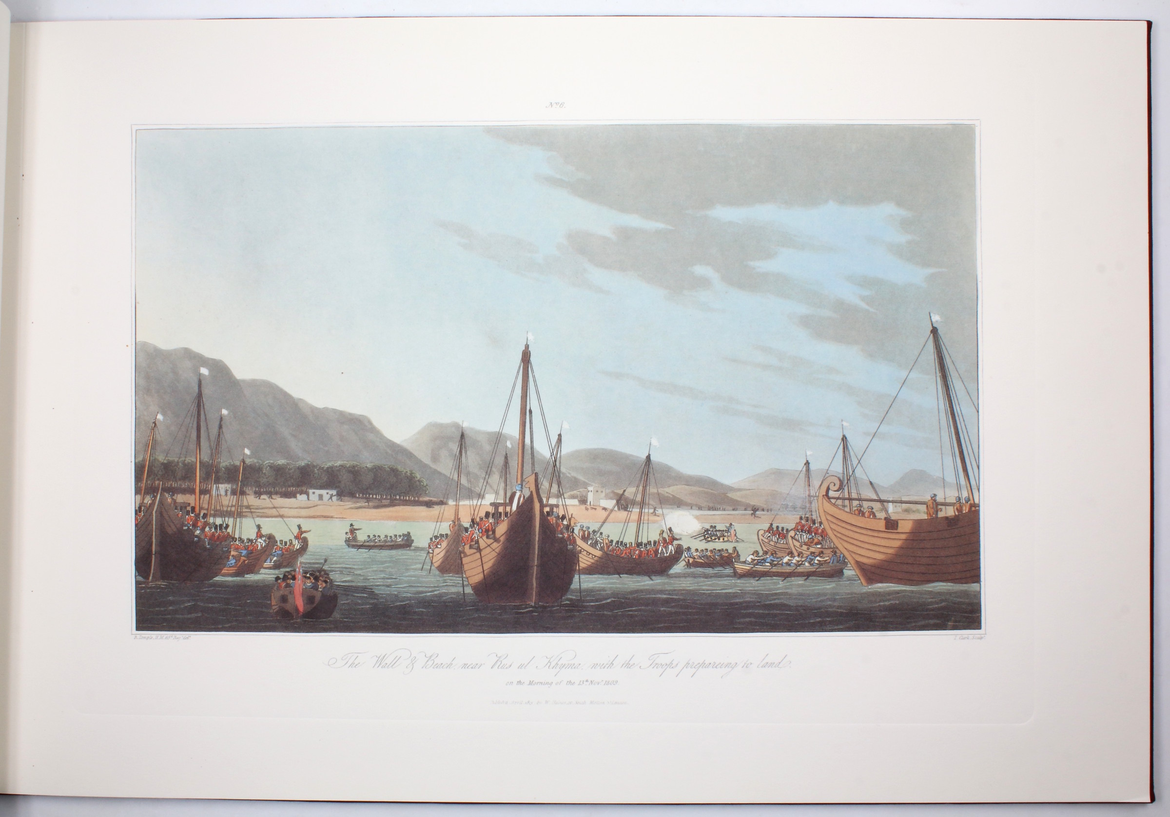
The shelling of Ras Al Khaimah
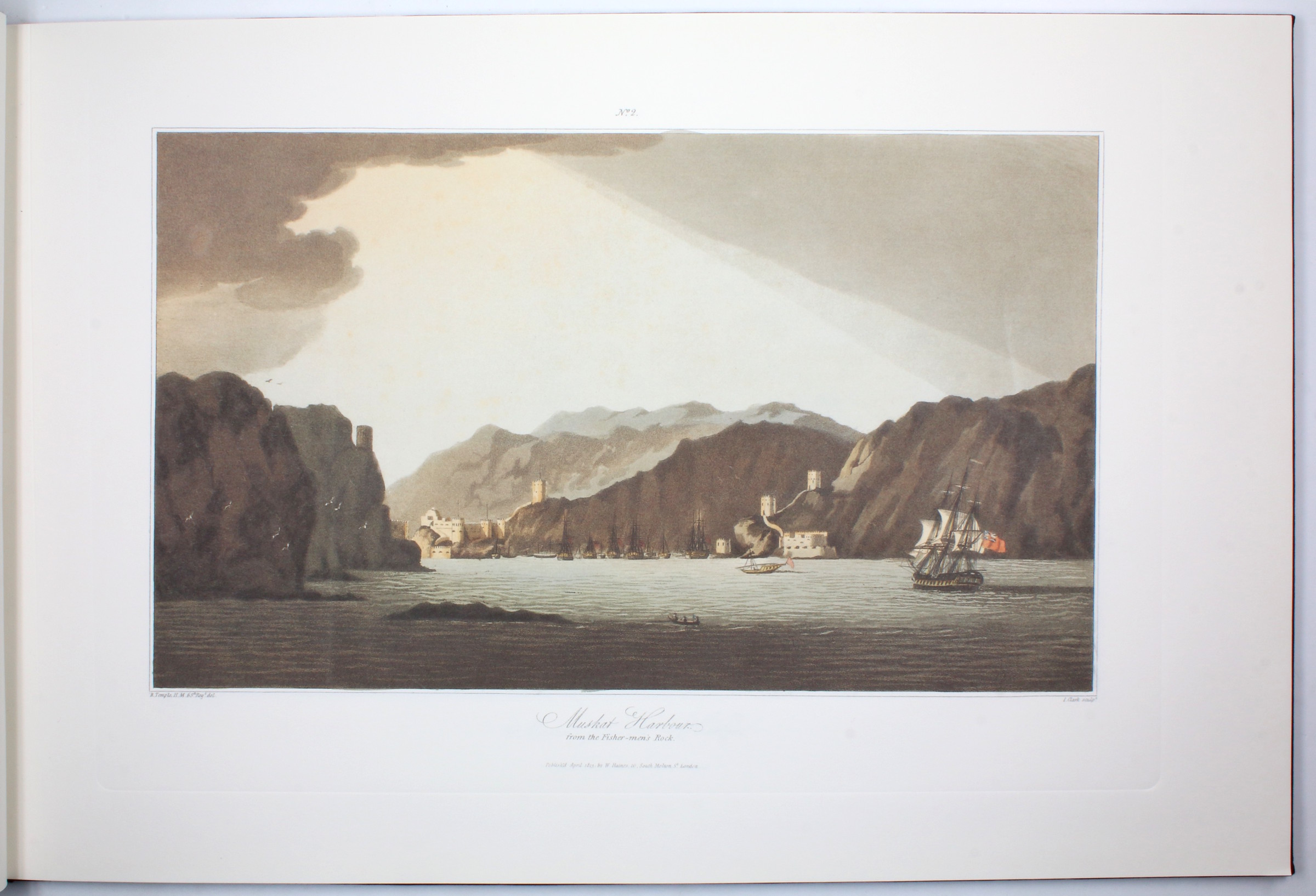
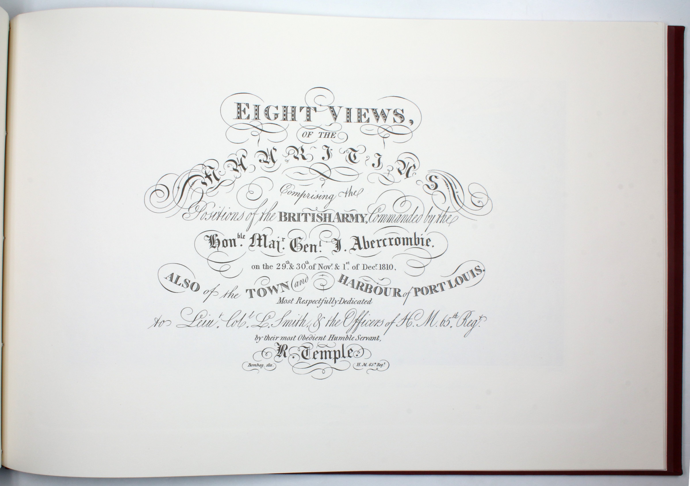
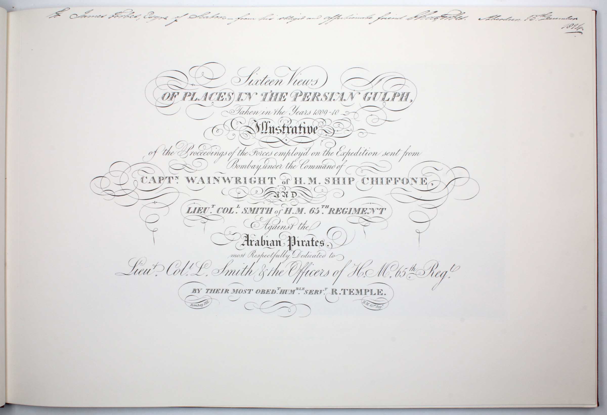
Sixteen Views of Places in the Persian Gulph, Taken in the Years 1809-10, Illustrative of the Proceedings of the Forces empoy'd on the Expedition sent from Bombay.
Oblong folio (505 x 335 mm). (2 ff.), 16 plates, (2 ff.), 8 plates. With 24 colour plates altogether. Full red cloth.
€ 750.00
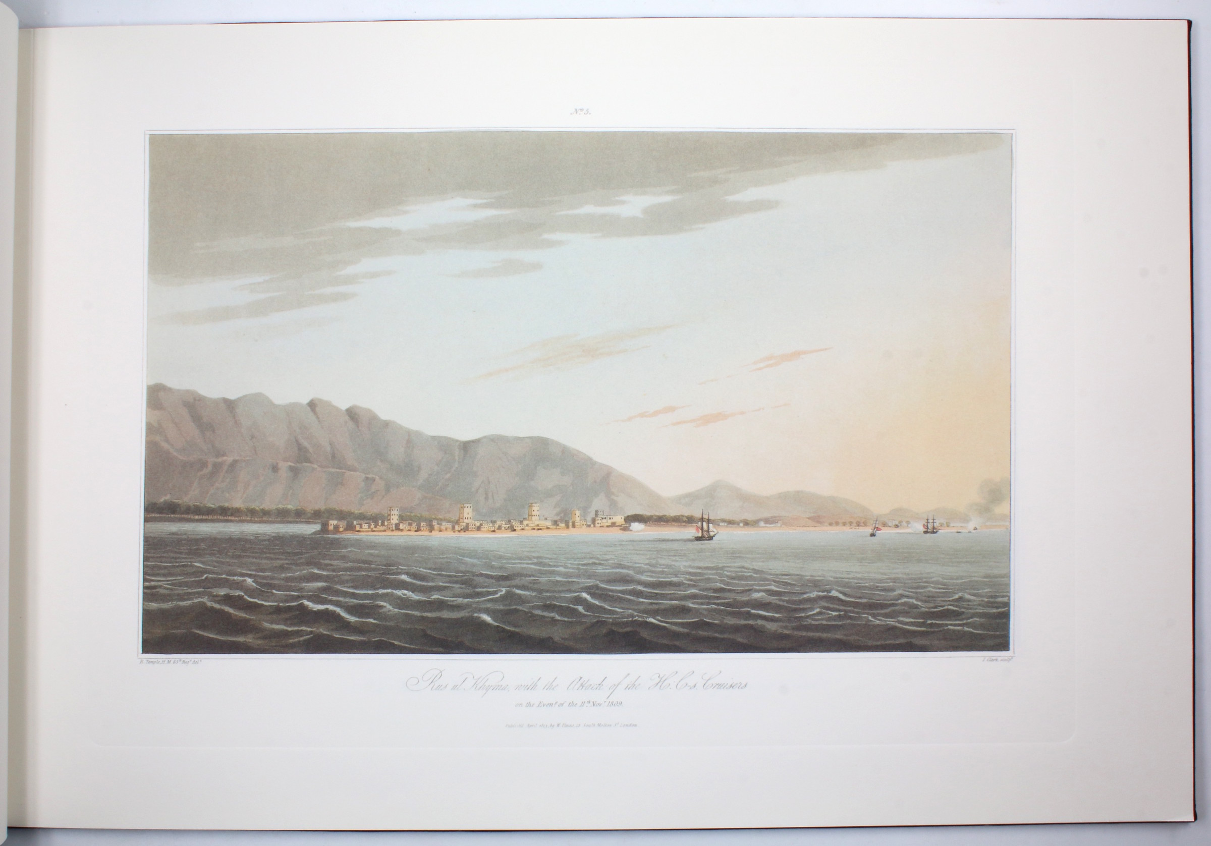
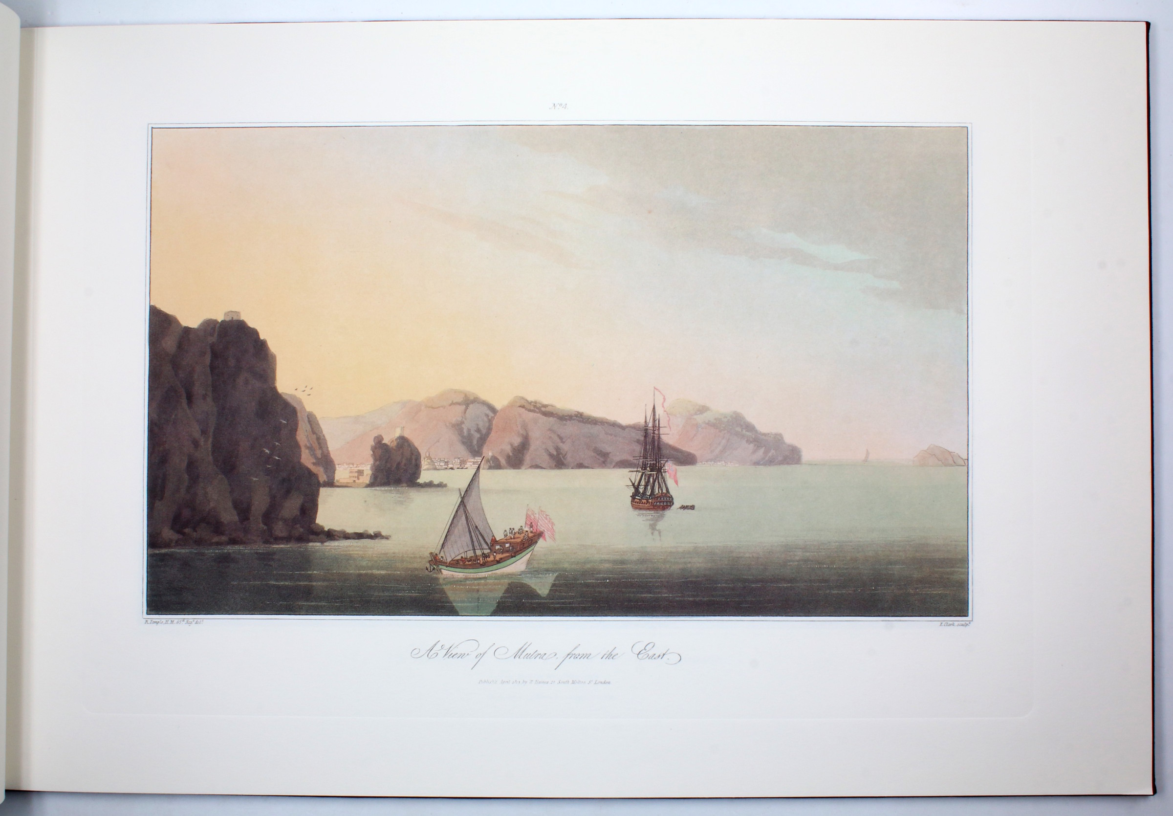
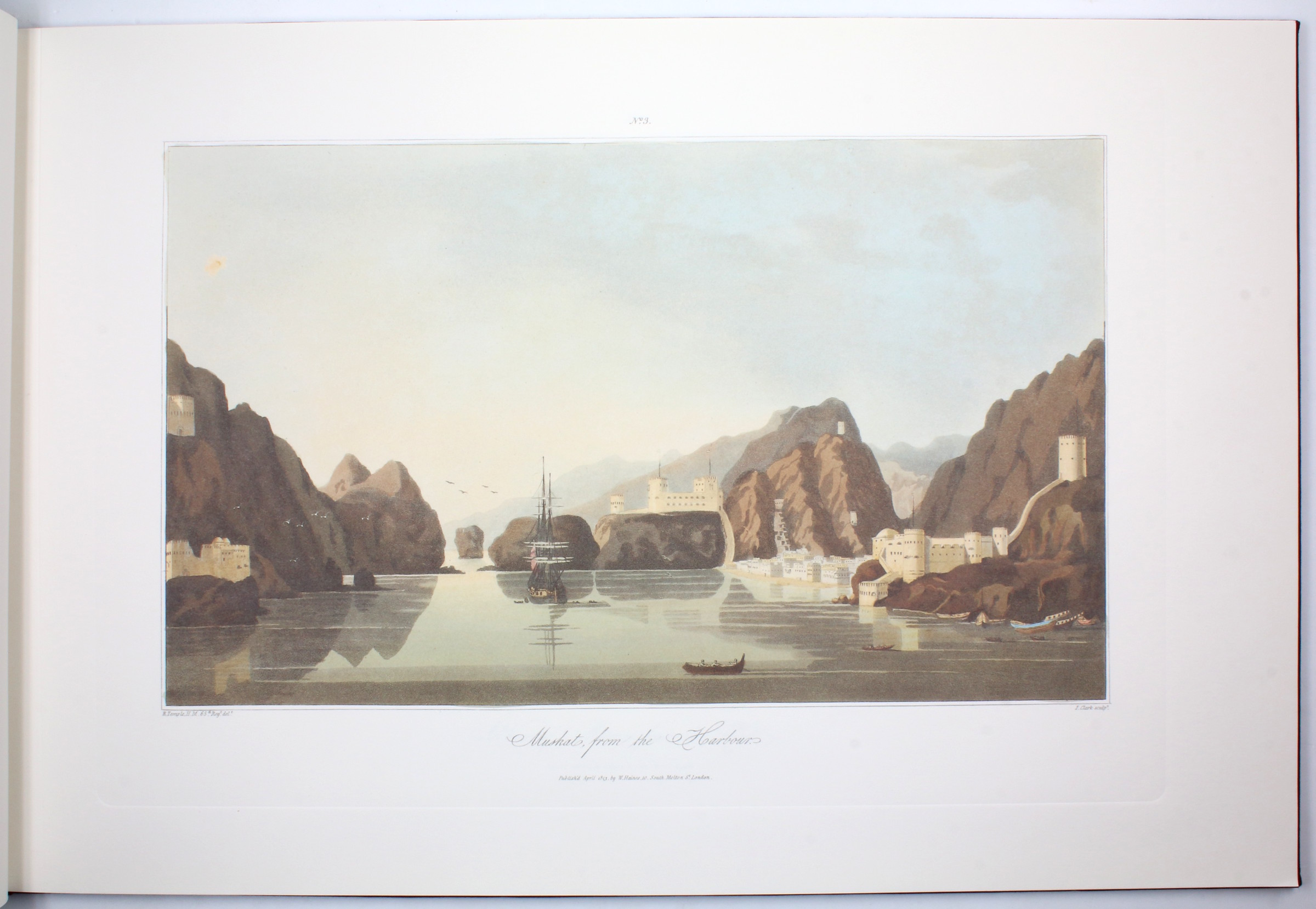
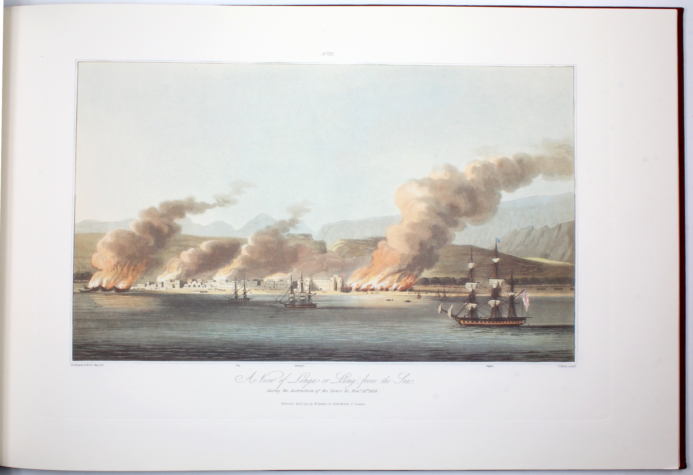
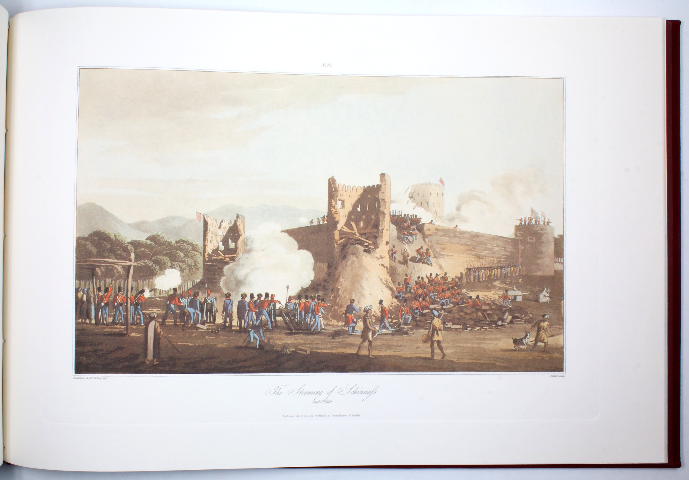
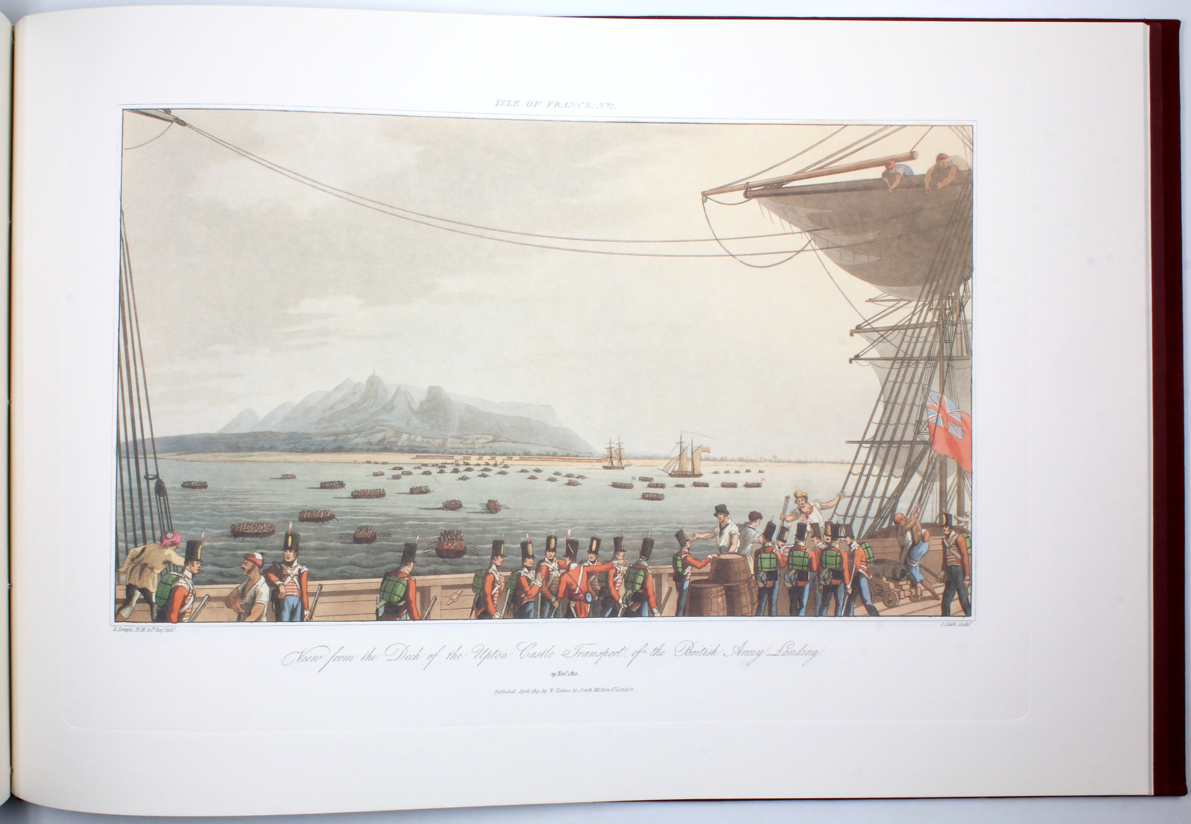
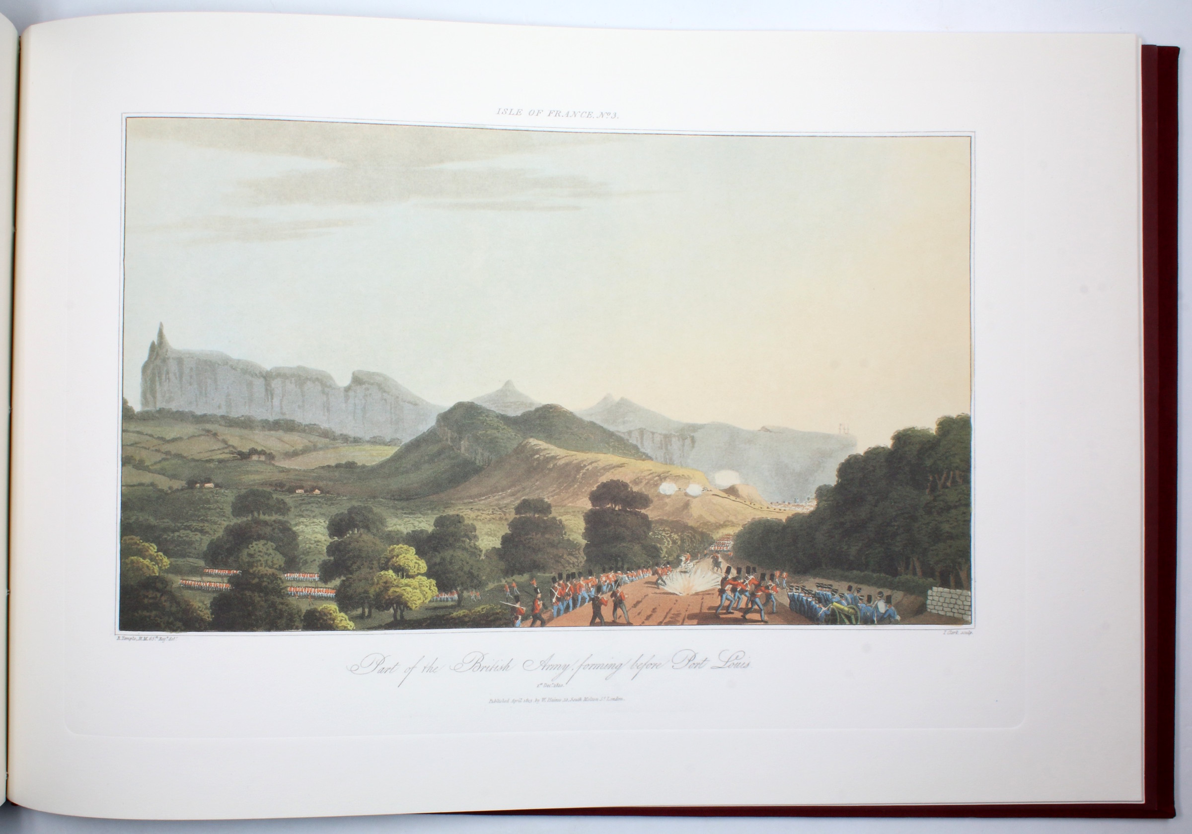
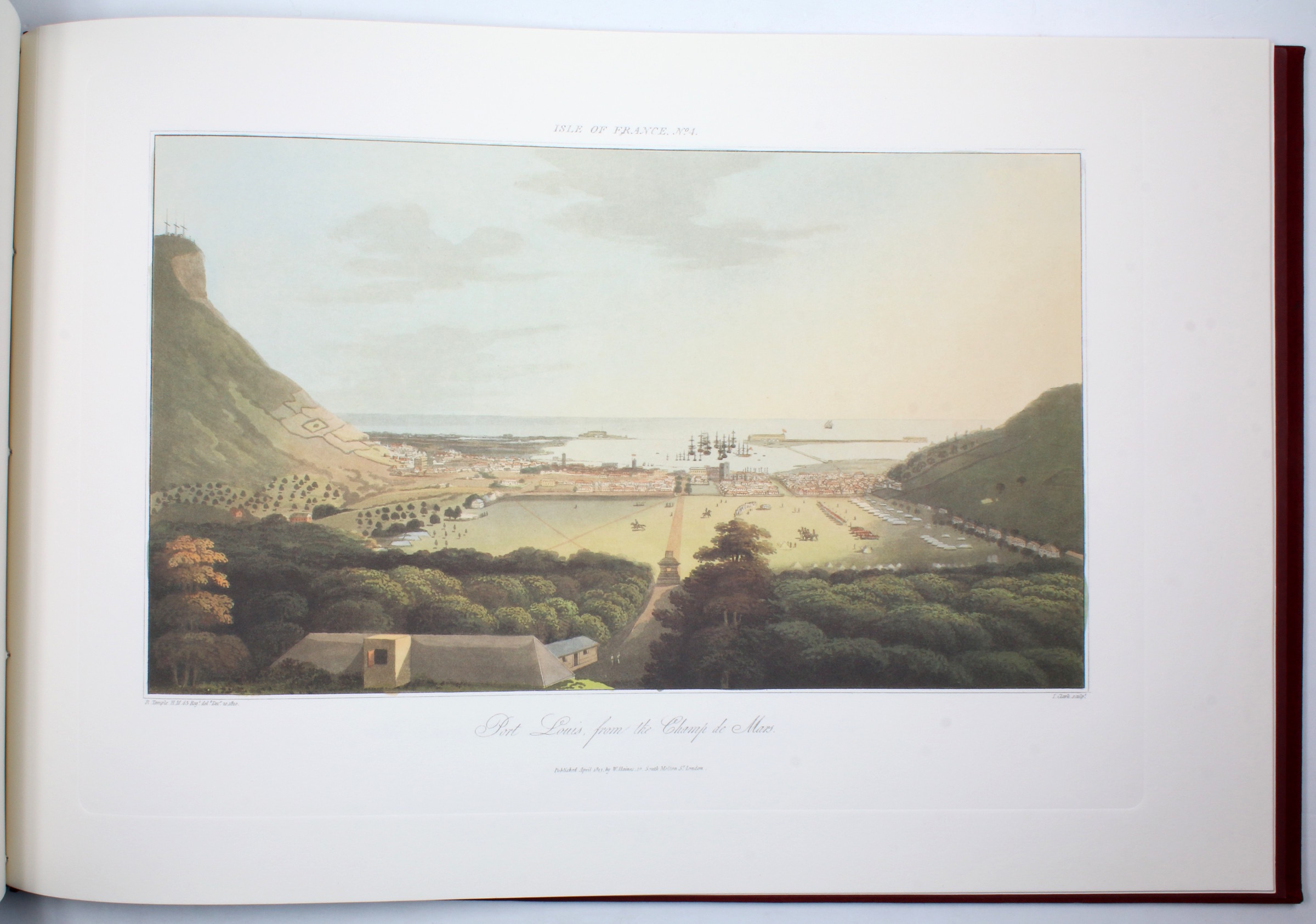
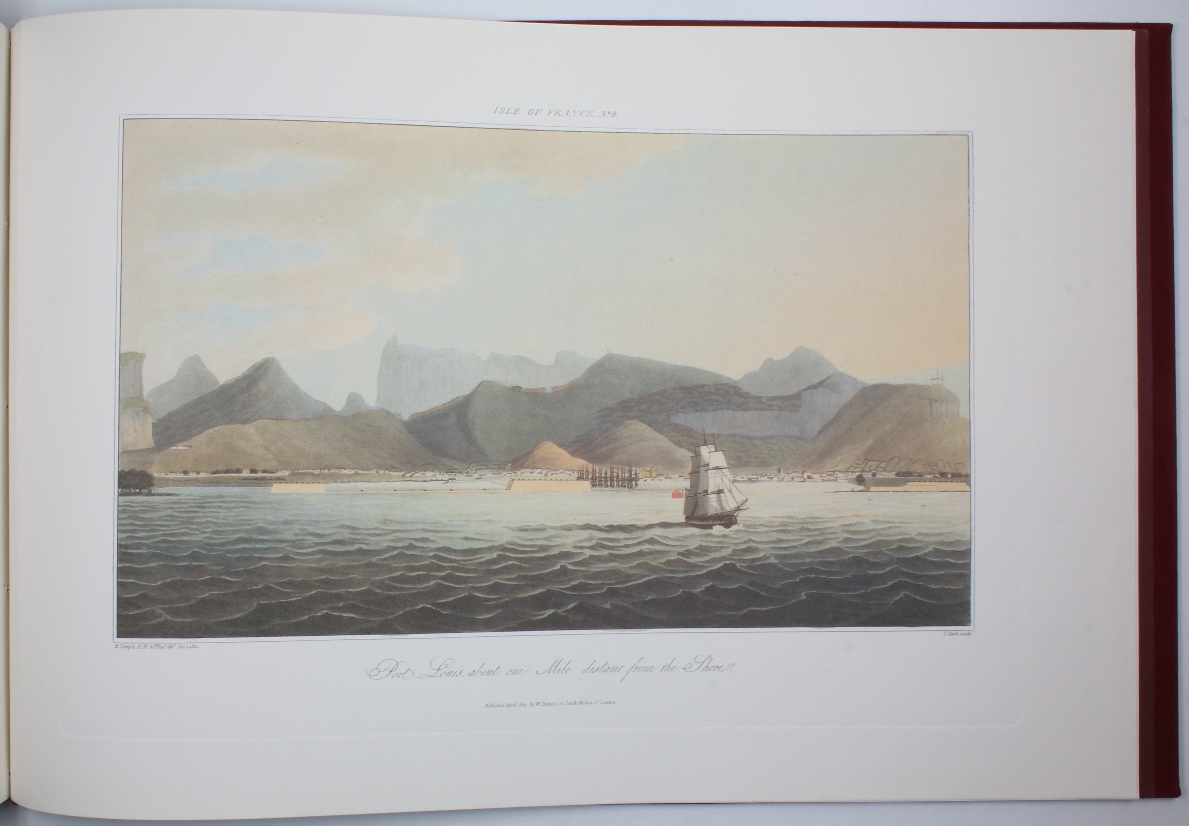
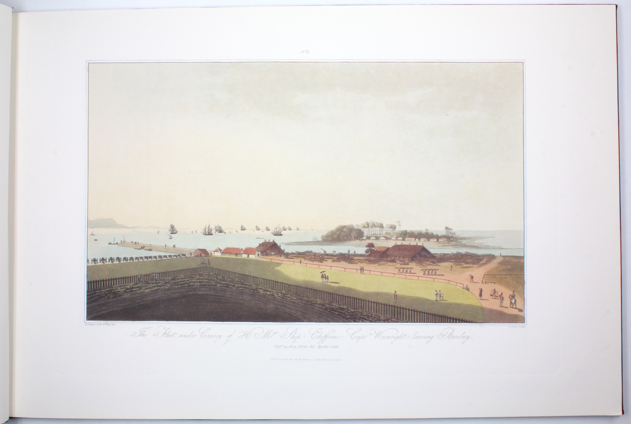
A very fine modern facsimile of this beautiful set of views considered one of the most renowned sources in the history of the Arabian Gulf, especially during the period when the Emirates of the Trucial Coast were beginning to define their borders and their power. Drawn by Richard Temple in 1809/10 CE, these views illustrate the battles resulting from the British East India Company's Gulf Campaign of 1809 under the command of Captain Wainwright and Lieutenant Colonel Smith.
Operating out of a base in Bombay, the Company sought and gained backing from Oman in order to attack Ras Al Khaimah, as they suspected the Al Qasimi and their Wahhabi allies of attacking their ships. This was especially concerning for the British, who prided themselves on naval power and, even more importantly, were anxious to preserve their shipping lanes between colonial British India and the rest of their empire.
The operation documented here is likely the second British campaign against Ras Al Khaimah and the Al Qasimi to take place in 1809. The plates include five spectacular views of the British bombardment and occupation of Ras Al Khaimah City, a rare view of Khor Fakkan in Sharjah, as well as view of the British fleet and army amassing before battles, two views of Muscat, and many others.
In perfect condition.
Cf. Abbey, Travel 389, 293. Bobbins I, 115 & 274. Tooley (1954) 482, 481.
Related
-
![Al-kitab al-sanawiu li-dawlat al'iimarat al-arabiat al-mutahida 1977 [United Arab Emirates Yearbook 1977].](https://inlibris.com/wp-content/uploads/2025/07/img-bn67677-324x324.jpg)
Al-kitab al-sanawiu li-dawlat al'iimarat al-arabiat al-mutahida 1977 [United …Abu Dhabi, 1978.
€ 950.00 -
![The postal issues of Hejaz, Jeddah and Nejd. [Signed by the author].](https://inlibris.com/wp-content/uploads/2023/06/img-bn61569-324x324.jpg)
The postal issues of Hejaz, Jeddah and Nejd. [Signed by the author].London, 1927.
€ 3,000.00 -

The Buraimi Dispute. A Summary of Facts Regarding British Seizure of Territory …New York, 1955.
€ 3,500.00 -
History of the Indian Navy (1613-1863).London, 1877.
€ 2,500.00